OXF Oxford, Mississippi, USA - Earthquake Result Viewer
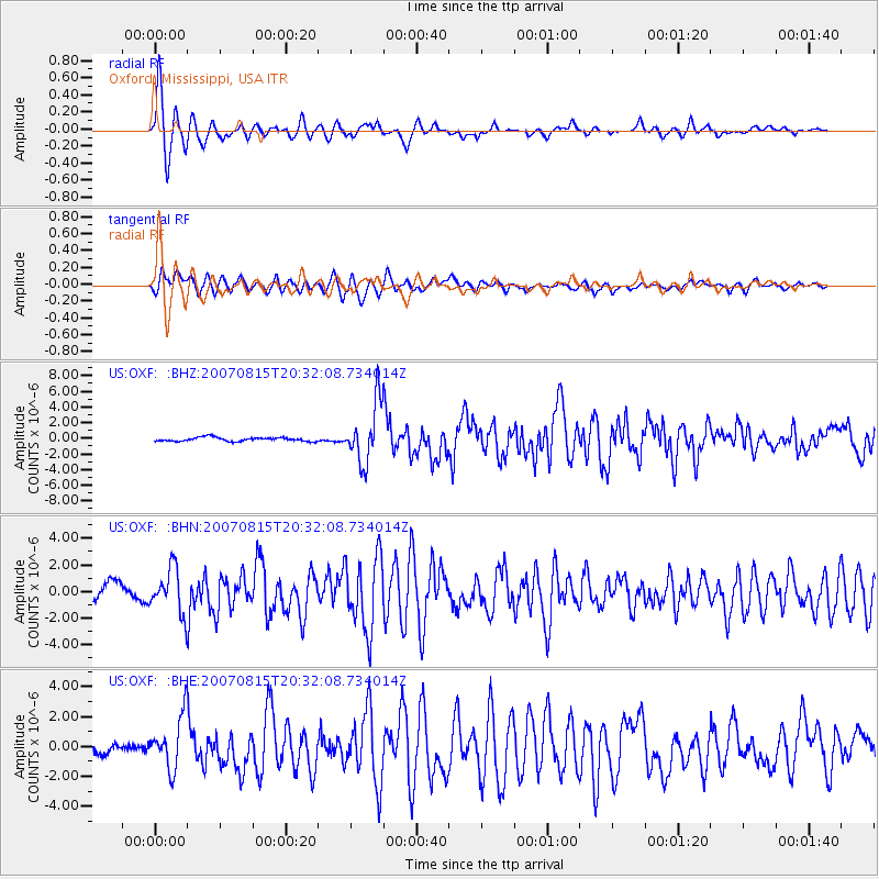
Earthquake location: Andreanof Islands, Aleutian Is.
Earthquake latitude/longitude: 50.3/-177.5
Earthquake time(UTC): 2007/08/15 (227) 20:22:11 GMT
Earthquake Depth: 9.0 km
Earthquake Magnitude: 6.3 MB, 6.2 MS, 6.4 MW, 5.9 ML
Earthquake Catalog/Contributor: WHDF/NEIC
Network: US United States National Seismic Network
Station: OXF Oxford, Mississippi, USA
Lat/Lon: 34.51 N/89.41 W
Elevation: 101 m
Distance: 63.3 deg
Az: 67.555 deg
Baz: 314.156 deg
Ray Param: 0.05969988
Estimated Moho Depth: 10.0 km
Estimated Crust Vp/Vs: 1.60
Assumed Crust Vp: 6.38 km/s
Estimated Crust Vs: 3.988 km/s
Estimated Crust Poisson's Ratio: 0.18
Radial Match: 94.24342 %
Radial Bump: 400
Transverse Match: 81.515465 %
Transverse Bump: 400
SOD ConfigId: 2564
Insert Time: 2010-03-05 06:02:17.204 +0000
GWidth: 2.5
Max Bumps: 400
Tol: 0.001

Signal To Noise

ChannelStoNSTALTA
US:OXF: :BHN:20070815T20:32:08.734014Z1.65188561.6721455E-61.0122646E-6
US:OXF: :BHE:20070815T20:32:08.734014Z4.5010821.7960165E-63.9901883E-7
US:OXF: :BHZ:20070815T20:32:08.734014Z15.2416893.8045896E-62.4961733E-7
Arrivals
Ps1.0 SECOND
PpPs3.9 SECOND
PsPs/PpSs4.9 SECOND