You are here: Home > Network List > CI - Caltech Regional Seismic Network Stations List
> Station MLAC Mammoth Lakes, California, USA > Earthquake Result Viewer
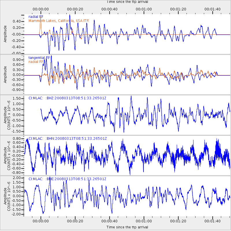
MLAC Mammoth Lakes, California, USA - Earthquake Result Viewer
*The percent match for this event was below the threshold and hence no stack was calculated.
| Earthquake location: |
Kuril Islands |
| Earthquake latitude/longitude: |
43.1/146.5 |
| Earthquake time(UTC): |
2008/03/13 (073) 08:41:07 GMT |
| Earthquake Depth: |
53 km |
| Earthquake Magnitude: |
5.6 MB, 5.4 MW, 5.3 MW |
| Earthquake Catalog/Contributor: |
WHDF/NEIC |
|
| Network: |
CI Caltech Regional Seismic Network |
| Station: |
MLAC Mammoth Lakes, California, USA |
| Lat/Lon: |
37.63 N/118.84 W |
| Elevation: |
2134 m |
|
| Distance: |
68.5 deg |
| Az: |
58.275 deg |
| Baz: |
308.267 deg |
| Ray Param: |
$rayparam |
*The percent match for this event was below the threshold and hence was not used in the summary stack. |
|
| Radial Match: |
67.974 % |
| Radial Bump: |
400 |
| Transverse Match: |
74.46812 % |
| Transverse Bump: |
400 |
| SOD ConfigId: |
2504 |
| Insert Time: |
2010-02-26 00:38:47.468 +0000 |
| GWidth: |
2.5 |
| Max Bumps: |
400 |
| Tol: |
0.001 |
|
Signal To Noise
| Channel | StoN | STA | LTA |
| CI:MLAC: :BHN:20080313T08:51:33.26501Z | 0.9314584 | 3.139548E-7 | 3.3705726E-7 |
| CI:MLAC: :BHE:20080313T08:51:33.26501Z | 1.5540283 | 1.0048623E-6 | 6.4661776E-7 |
| CI:MLAC: :BHZ:20080313T08:51:33.26501Z | 0.9436713 | 3.794081E-7 | 4.0205535E-7 |
| Arrivals |
| Ps | |
| PpPs | |
| PsPs/PpSs | |


