You are here: Home > Network List > TA - USArray Transportable Network (new EarthScope stations) Stations List
> Station R17K Ugashik Creek, AK, USA > Earthquake Result Viewer
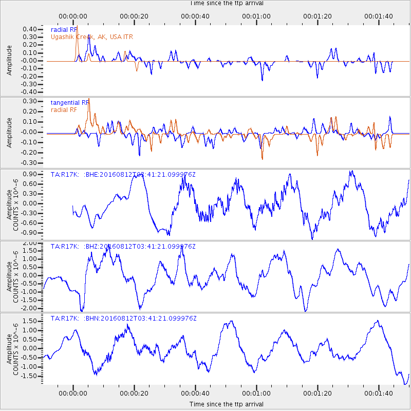
R17K Ugashik Creek, AK, USA - Earthquake Result Viewer
*The percent match for this event was below the threshold and hence no stack was calculated.
| Earthquake location: |
South Of Fiji Islands |
| Earthquake latitude/longitude: |
-25.2/-177.0 |
| Earthquake time(UTC): |
2016/08/12 (225) 03:29:27 GMT |
| Earthquake Depth: |
75 km |
| Earthquake Magnitude: |
6.1 MO |
| Earthquake Catalog/Contributor: |
NEIC PDE/NEIC ALERT |
|
| Network: |
TA USArray Transportable Network (new EarthScope stations) |
| Station: |
R17K Ugashik Creek, AK, USA |
| Lat/Lon: |
57.64 N/156.39 W |
| Elevation: |
273 m |
|
| Distance: |
84.3 deg |
| Az: |
10.971 deg |
| Baz: |
198.699 deg |
| Ray Param: |
$rayparam |
*The percent match for this event was below the threshold and hence was not used in the summary stack. |
|
| Radial Match: |
71.49432 % |
| Radial Bump: |
246 |
| Transverse Match: |
61.45275 % |
| Transverse Bump: |
311 |
| SOD ConfigId: |
11737051 |
| Insert Time: |
2019-04-25 06:19:47.496 +0000 |
| GWidth: |
2.5 |
| Max Bumps: |
400 |
| Tol: |
0.001 |
|
Signal To Noise
| Channel | StoN | STA | LTA |
| TA:R17K: :BHZ:20160812T03:41:21.099976Z | 2.1446257 | 1.2898854E-6 | 6.0145015E-7 |
| TA:R17K: :BHN:20160812T03:41:21.099976Z | 3.2402537 | 6.943819E-7 | 2.1429864E-7 |
| TA:R17K: :BHE:20160812T03:41:21.099976Z | 1.7209778 | 7.9627114E-7 | 4.6268528E-7 |
| Arrivals |
| Ps | |
| PpPs | |
| PsPs/PpSs | |


