You are here: Home > Network List > UW - Pacific Northwest Regional Seismic Network Stations List
> Station FISH Seaside, OR, USA > Earthquake Result Viewer
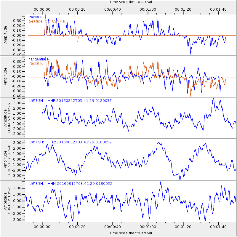
FISH Seaside, OR, USA - Earthquake Result Viewer
*The percent match for this event was below the threshold and hence no stack was calculated.
| Earthquake location: |
South Of Fiji Islands |
| Earthquake latitude/longitude: |
-25.2/-177.0 |
| Earthquake time(UTC): |
2016/08/12 (225) 03:29:27 GMT |
| Earthquake Depth: |
75 km |
| Earthquake Magnitude: |
6.1 MO |
| Earthquake Catalog/Contributor: |
NEIC PDE/NEIC ALERT |
|
| Network: |
UW Pacific Northwest Regional Seismic Network |
| Station: |
FISH Seaside, OR, USA |
| Lat/Lon: |
45.93 N/123.56 W |
| Elevation: |
325 m |
|
| Distance: |
85.8 deg |
| Az: |
34.206 deg |
| Baz: |
226.864 deg |
| Ray Param: |
$rayparam |
*The percent match for this event was below the threshold and hence was not used in the summary stack. |
|
| Radial Match: |
59.030685 % |
| Radial Bump: |
400 |
| Transverse Match: |
48.017117 % |
| Transverse Bump: |
400 |
| SOD ConfigId: |
11737051 |
| Insert Time: |
2019-04-25 06:20:11.147 +0000 |
| GWidth: |
2.5 |
| Max Bumps: |
400 |
| Tol: |
0.001 |
|
Signal To Noise
| Channel | StoN | STA | LTA |
| UW:FISH: :HHZ:20160812T03:41:29.018005Z | 1.5718048 | 1.9245274E-6 | 1.2244061E-6 |
| UW:FISH: :HHN:20160812T03:41:29.018005Z | 1.3049524 | 1.1058615E-6 | 8.474345E-7 |
| UW:FISH: :HHE:20160812T03:41:29.018005Z | 1.0348648 | 1.012679E-6 | 9.785617E-7 |
| Arrivals |
| Ps | |
| PpPs | |
| PsPs/PpSs | |


