OXF Oxford, Mississippi, USA - Earthquake Result Viewer
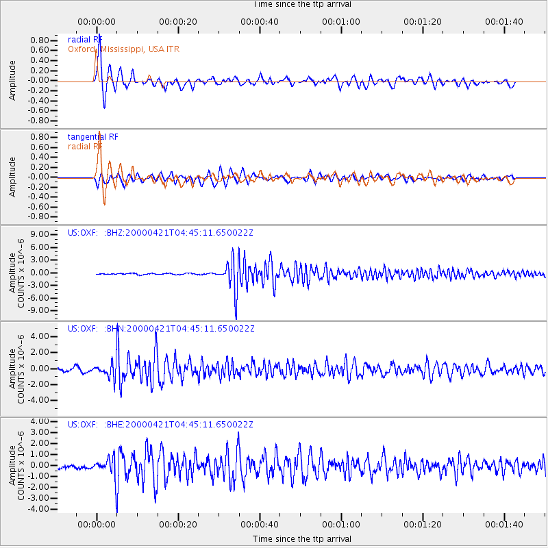
Earthquake location: Andreanof Islands, Aleutian Is.
Earthquake latitude/longitude: 51.4/-178.1
Earthquake time(UTC): 2000/04/21 (112) 04:35:17 GMT
Earthquake Depth: 33 km
Earthquake Magnitude: 6.0 MB, 5.7 MS, 6.2 ML, 6.0 MW
Earthquake Catalog/Contributor: WHDF/NEIC
Network: US United States National Seismic Network
Station: OXF Oxford, Mississippi, USA
Lat/Lon: 34.51 N/89.41 W
Elevation: 101 m
Distance: 63.2 deg
Az: 67.685 deg
Baz: 315.456 deg
Ray Param: 0.059692077
Estimated Moho Depth: 10.0 km
Estimated Crust Vp/Vs: 1.60
Assumed Crust Vp: 6.38 km/s
Estimated Crust Vs: 3.988 km/s
Estimated Crust Poisson's Ratio: 0.18
Radial Match: 94.4068 %
Radial Bump: 400
Transverse Match: 90.26327 %
Transverse Bump: 400
SOD ConfigId: 110165
Insert Time: 2010-03-05 06:03:39.649 +0000
GWidth: 2.5
Max Bumps: 400
Tol: 0.001

Signal To Noise

ChannelStoNSTALTA
US:OXF: :BHN:20000421T04:45:11.650022Z3.92084078.54861E-72.1803002E-7
US:OXF: :BHE:20000421T04:45:11.650022Z4.33991679.2262144E-72.1258965E-7
US:OXF: :BHZ:20000421T04:45:11.650022Z27.874373.6744286E-61.3182105E-7
Arrivals
Ps1.0 SECOND
PpPs3.9 SECOND
PsPs/PpSs4.9 SECOND