You are here: Home > Network List > GS - US Geological Survey Networks Stations List
> Station DEC12 Decatur Surface Seismic Site, Decatur, IL, USA > Earthquake Result Viewer
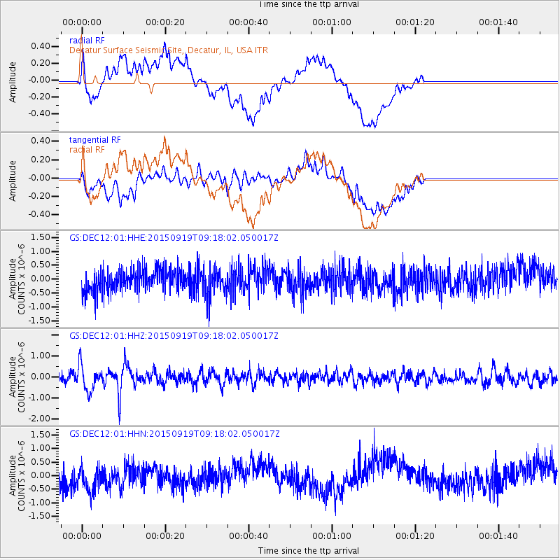
DEC12 Decatur Surface Seismic Site, Decatur, IL, USA - Earthquake Result Viewer
*The percent match for this event was below the threshold and hence no stack was calculated.
| Earthquake location: |
Near Coast Of Central Chile |
| Earthquake latitude/longitude: |
-31.1/-71.6 |
| Earthquake time(UTC): |
2015/09/19 (262) 09:07:08 GMT |
| Earthquake Depth: |
23 km |
| Earthquake Magnitude: |
6.1 MWP |
| Earthquake Catalog/Contributor: |
NEIC PDE/NEIC COMCAT |
|
| Network: |
GS US Geological Survey Networks |
| Station: |
DEC12 Decatur Surface Seismic Site, Decatur, IL, USA |
| Lat/Lon: |
39.91 N/88.91 W |
| Elevation: |
208 m |
|
| Distance: |
72.5 deg |
| Az: |
346.123 deg |
| Baz: |
164.489 deg |
| Ray Param: |
$rayparam |
*The percent match for this event was below the threshold and hence was not used in the summary stack. |
|
| Radial Match: |
47.423347 % |
| Radial Bump: |
400 |
| Transverse Match: |
40.71709 % |
| Transverse Bump: |
400 |
| SOD ConfigId: |
1156111 |
| Insert Time: |
2015-10-03 09:28:32.149 +0000 |
| GWidth: |
2.5 |
| Max Bumps: |
400 |
| Tol: |
0.001 |
|
Signal To Noise
| Channel | StoN | STA | LTA |
| GS:DEC12:01:HHZ:20150919T09:18:02.050017Z | 3.2193017 | 6.1997764E-7 | 1.925814E-7 |
| GS:DEC12:01:HHN:20150919T09:18:02.050017Z | 1.4360465 | 6.2863415E-7 | 4.3775336E-7 |
| GS:DEC12:01:HHE:20150919T09:18:02.050017Z | 1.3037864 | 5.066628E-7 | 3.886087E-7 |
| Arrivals |
| Ps | |
| PpPs | |
| PsPs/PpSs | |


