You are here: Home > Network List > TA - USArray Transportable Network (new EarthScope stations) Stations List
> Station WHTX Lake Whitney, Meridian, TX, USA > Earthquake Result Viewer
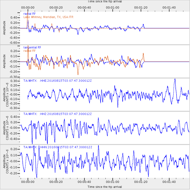
WHTX Lake Whitney, Meridian, TX, USA - Earthquake Result Viewer
*The percent match for this event was below the threshold and hence no stack was calculated.
| Earthquake location: |
Southern Peru |
| Earthquake latitude/longitude: |
-15.7/-72.0 |
| Earthquake time(UTC): |
2016/08/15 (228) 02:59:00 GMT |
| Earthquake Depth: |
20 km |
| Earthquake Magnitude: |
5.5 mwb |
| Earthquake Catalog/Contributor: |
NEIC PDE/ |
|
| Network: |
TA USArray Transportable Network (new EarthScope stations) |
| Station: |
WHTX Lake Whitney, Meridian, TX, USA |
| Lat/Lon: |
31.99 N/97.46 W |
| Elevation: |
190 m |
|
| Distance: |
53.3 deg |
| Az: |
332.915 deg |
| Baz: |
148.922 deg |
| Ray Param: |
$rayparam |
*The percent match for this event was below the threshold and hence was not used in the summary stack. |
|
| Radial Match: |
58.14414 % |
| Radial Bump: |
400 |
| Transverse Match: |
52.94724 % |
| Transverse Bump: |
400 |
| SOD ConfigId: |
11737051 |
| Insert Time: |
2019-04-25 06:57:49.115 +0000 |
| GWidth: |
2.5 |
| Max Bumps: |
400 |
| Tol: |
0.001 |
|
Signal To Noise
| Channel | StoN | STA | LTA |
| TA:WHTX: :HHZ:20160815T03:07:47.300012Z | 2.742215 | 1.8028071E-7 | 6.574273E-8 |
| TA:WHTX: :HHN:20160815T03:07:47.300012Z | 1.9780642 | 1.1080463E-7 | 5.60167E-8 |
| TA:WHTX: :HHE:20160815T03:07:47.300012Z | 1.2031802 | 7.5457244E-8 | 6.271483E-8 |
| Arrivals |
| Ps | |
| PpPs | |
| PsPs/PpSs | |


