You are here: Home > Network List > CI - Caltech Regional Seismic Network Stations List
> Station SWS Sam W. Stewart, Westmorland, CA, USA > Earthquake Result Viewer
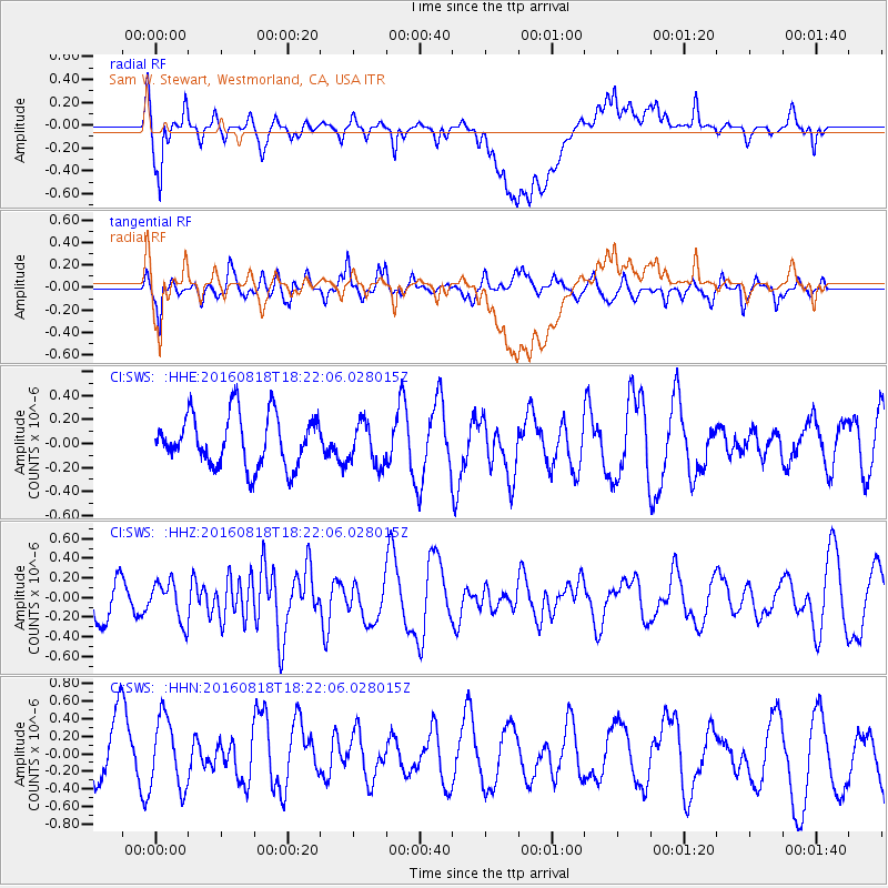
SWS Sam W. Stewart, Westmorland, CA, USA - Earthquake Result Viewer
*The percent match for this event was below the threshold and hence no stack was calculated.
| Earthquake location: |
Southern East Pacific Rise |
| Earthquake latitude/longitude: |
-56.0/-123.2 |
| Earthquake time(UTC): |
2016/08/18 (231) 18:09:45 GMT |
| Earthquake Depth: |
9.5 km |
| Earthquake Magnitude: |
5.5 MB |
| Earthquake Catalog/Contributor: |
NEIC PDE/NEIC ALERT |
|
| Network: |
CI Caltech Regional Seismic Network |
| Station: |
SWS Sam W. Stewart, Westmorland, CA, USA |
| Lat/Lon: |
32.94 N/115.80 W |
| Elevation: |
140 m |
|
| Distance: |
88.8 deg |
| Az: |
6.215 deg |
| Baz: |
184.152 deg |
| Ray Param: |
$rayparam |
*The percent match for this event was below the threshold and hence was not used in the summary stack. |
|
| Radial Match: |
63.45316 % |
| Radial Bump: |
400 |
| Transverse Match: |
66.26105 % |
| Transverse Bump: |
400 |
| SOD ConfigId: |
11737051 |
| Insert Time: |
2019-04-25 07:05:38.845 +0000 |
| GWidth: |
2.5 |
| Max Bumps: |
400 |
| Tol: |
0.001 |
|
Signal To Noise
| Channel | StoN | STA | LTA |
| CI:SWS: :HHZ:20160818T18:22:06.028015Z | 0.86463755 | 2.0431794E-7 | 2.3630473E-7 |
| CI:SWS: :HHN:20160818T18:22:06.028015Z | 0.8918665 | 4.147136E-7 | 4.6499517E-7 |
| CI:SWS: :HHE:20160818T18:22:06.028015Z | 0.8239526 | 1.7571924E-7 | 2.1326377E-7 |
| Arrivals |
| Ps | |
| PpPs | |
| PsPs/PpSs | |


