You are here: Home > Network List > CN - Canadian National Seismograph Network Stations List
> Station FRB IQALUIT, N.W.T. > Earthquake Result Viewer
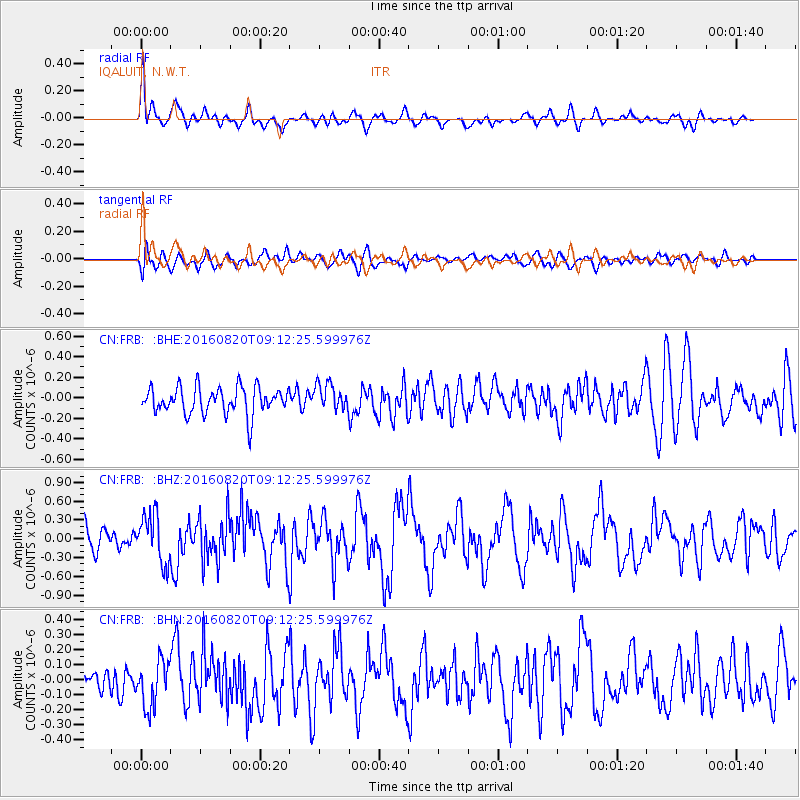
FRB IQALUIT, N.W.T. - Earthquake Result Viewer
*The percent match for this event was below the threshold and hence no stack was calculated.
| Earthquake location: |
Off East Coast Of Honshu, Japan |
| Earthquake latitude/longitude: |
40.4/143.7 |
| Earthquake time(UTC): |
2016/08/20 (233) 09:01:26 GMT |
| Earthquake Depth: |
10 km |
| Earthquake Magnitude: |
6.0 MO |
| Earthquake Catalog/Contributor: |
NEIC PDE/NEIC ALERT |
|
| Network: |
CN Canadian National Seismograph Network |
| Station: |
FRB IQALUIT, N.W.T. |
| Lat/Lon: |
63.75 N/68.55 W |
| Elevation: |
18 m |
|
| Distance: |
73.1 deg |
| Az: |
14.349 deg |
| Baz: |
334.796 deg |
| Ray Param: |
$rayparam |
*The percent match for this event was below the threshold and hence was not used in the summary stack. |
|
| Radial Match: |
79.521 % |
| Radial Bump: |
400 |
| Transverse Match: |
51.325226 % |
| Transverse Bump: |
400 |
| SOD ConfigId: |
11737051 |
| Insert Time: |
2019-04-25 07:32:14.394 +0000 |
| GWidth: |
2.5 |
| Max Bumps: |
400 |
| Tol: |
0.001 |
|
Signal To Noise
| Channel | StoN | STA | LTA |
| CN:FRB: :BHZ:20160820T09:12:25.599976Z | 2.1274297 | 3.8591907E-7 | 1.8140156E-7 |
| CN:FRB: :BHN:20160820T09:12:25.599976Z | 1.9782368 | 1.5442774E-7 | 7.806332E-8 |
| CN:FRB: :BHE:20160820T09:12:25.599976Z | 0.97765017 | 1.2646296E-7 | 1.29354E-7 |
| Arrivals |
| Ps | |
| PpPs | |
| PsPs/PpSs | |


