You are here: Home > Network List > US - United States National Seismic Network Stations List
> Station DGMT Dagmar, Montana, USA > Earthquake Result Viewer
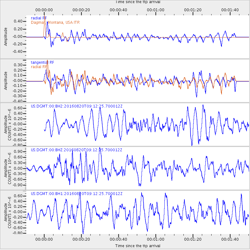
DGMT Dagmar, Montana, USA - Earthquake Result Viewer
*The percent match for this event was below the threshold and hence no stack was calculated.
| Earthquake location: |
Off East Coast Of Honshu, Japan |
| Earthquake latitude/longitude: |
40.4/143.7 |
| Earthquake time(UTC): |
2016/08/20 (233) 09:01:26 GMT |
| Earthquake Depth: |
10 km |
| Earthquake Magnitude: |
6.0 MO |
| Earthquake Catalog/Contributor: |
NEIC PDE/NEIC ALERT |
|
| Network: |
US United States National Seismic Network |
| Station: |
DGMT Dagmar, Montana, USA |
| Lat/Lon: |
48.47 N/104.20 W |
| Elevation: |
0.0 m |
|
| Distance: |
73.1 deg |
| Az: |
40.103 deg |
| Baz: |
312.297 deg |
| Ray Param: |
$rayparam |
*The percent match for this event was below the threshold and hence was not used in the summary stack. |
|
| Radial Match: |
45.601364 % |
| Radial Bump: |
400 |
| Transverse Match: |
59.5501 % |
| Transverse Bump: |
399 |
| SOD ConfigId: |
11737051 |
| Insert Time: |
2019-04-25 07:38:43.795 +0000 |
| GWidth: |
2.5 |
| Max Bumps: |
400 |
| Tol: |
0.001 |
|
Signal To Noise
| Channel | StoN | STA | LTA |
| US:DGMT:00:BHZ:20160820T09:12:25.700012Z | 2.2807245 | 2.1063512E-7 | 9.2354476E-8 |
| US:DGMT:00:BH1:20160820T09:12:25.700012Z | 0.6046678 | 1.5857603E-7 | 2.6225314E-7 |
| US:DGMT:00:BH2:20160820T09:12:25.700012Z | 1.7256569 | 3.6309436E-7 | 2.1040935E-7 |
| Arrivals |
| Ps | |
| PpPs | |
| PsPs/PpSs | |


