MNTX Cornudas Mountains, Texas, USA - Earthquake Result Viewer
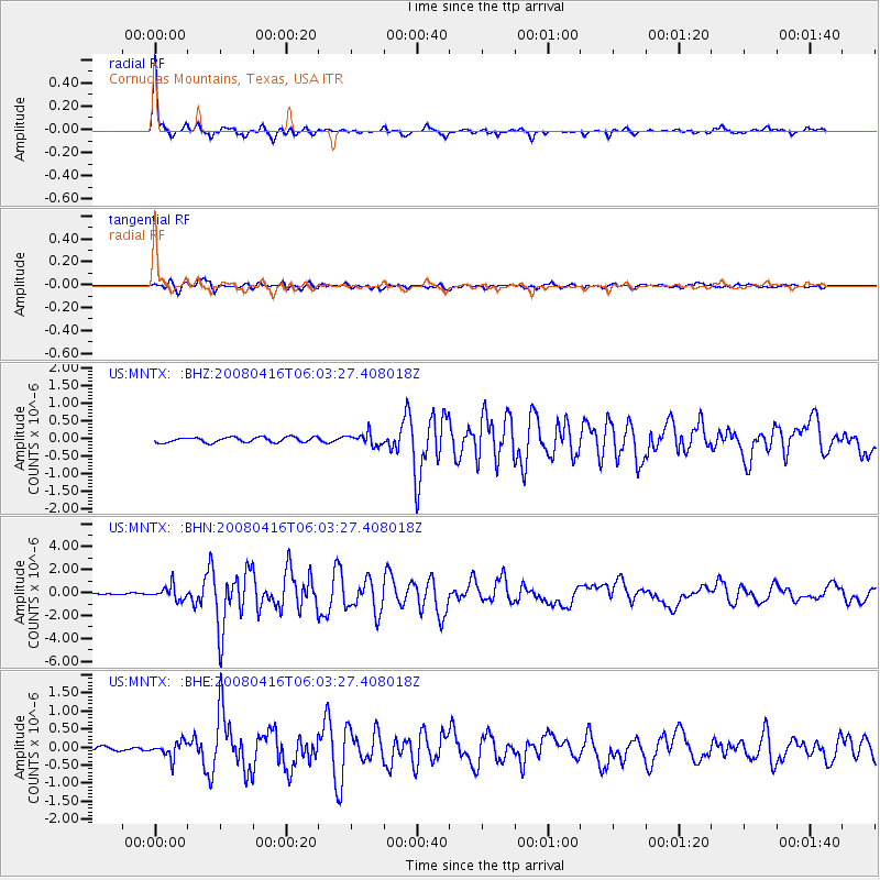
Earthquake location: Andreanof Islands, Aleutian Is.
Earthquake latitude/longitude: 51.9/-179.2
Earthquake time(UTC): 2008/04/16 (107) 05:54:19 GMT
Earthquake Depth: 13 km
Earthquake Magnitude: 6.1 MB, 6.5 MS, 6.6 MW, 6.6 MW
Earthquake Catalog/Contributor: WHDF/NEIC
Network: US United States National Seismic Network
Station: MNTX Cornudas Mountains, Texas, USA
Lat/Lon: 31.70 N/105.38 W
Elevation: 404 m
Distance: 56.1 deg
Az: 80.474 deg
Baz: 314.175 deg
Ray Param: 0.06436091
Estimated Moho Depth: 40.5 km
Estimated Crust Vp/Vs: 1.74
Assumed Crust Vp: 6.361 km/s
Estimated Crust Vs: 3.656 km/s
Estimated Crust Poisson's Ratio: 0.25
Radial Match: 95.73715 %
Radial Bump: 360
Transverse Match: 90.148636 %
Transverse Bump: 400
SOD ConfigId: 2504
Insert Time: 2010-03-05 06:15:33.347 +0000
GWidth: 2.5
Max Bumps: 400
Tol: 0.001

Signal To Noise

ChannelStoNSTALTA
US:MNTX: :BHN:20080416T06:03:27.408018Z9.5449145.8939634E-76.174978E-8
US:MNTX: :BHE:20080416T06:03:27.408018Z2.53792982.1688045E-78.545566E-8
US:MNTX: :BHZ:20080416T06:03:27.408018Z2.32994991.6931028E-77.2666914E-8
Arrivals
Ps5.0 SECOND
PpPs17 SECOND
PsPs/PpSs22 SECOND