MNTX Cornudas Mountains, Texas, USA - Earthquake Result Viewer
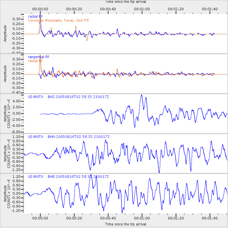
Earthquake location: Near East Coast Of Honshu, Japan
Earthquake latitude/longitude: 38.3/142.0
Earthquake time(UTC): 2005/08/16 (228) 02:46:28 GMT
Earthquake Depth: 36 km
Earthquake Magnitude: 6.5 MB, 6.8 MS, 7.2 MW, 7.1 MW
Earthquake Catalog/Contributor: WHDF/NEIC
Network: US United States National Seismic Network
Station: MNTX Cornudas Mountains, Texas, USA
Lat/Lon: 31.70 N/105.38 W
Elevation: 404 m
Distance: 86.3 deg
Az: 52.067 deg
Baz: 313.259 deg
Ray Param: 0.044119768
Estimated Moho Depth: 50.75 km
Estimated Crust Vp/Vs: 1.68
Assumed Crust Vp: 6.361 km/s
Estimated Crust Vs: 3.786 km/s
Estimated Crust Poisson's Ratio: 0.23
Radial Match: 95.687355 %
Radial Bump: 359
Transverse Match: 92.090485 %
Transverse Bump: 400
SOD ConfigId: 110165
Insert Time: 2010-03-05 06:15:58.526 +0000
GWidth: 2.5
Max Bumps: 400
Tol: 0.001

Signal To Noise

ChannelStoNSTALTA
US:MNTX: :BHN:20050816T02:58:35.230017Z2.88483381.7676193E-76.127283E-8
US:MNTX: :BHE:20050816T02:58:35.230017Z3.06113362.1582778E-77.0505834E-8
US:MNTX: :BHZ:20050816T02:58:35.230017Z8.0316997.52625E-79.370682E-8
Arrivals
Ps5.6 SECOND
PpPs21 SECOND
PsPs/PpSs26 SECOND