You are here: Home > Network List > CI - Caltech Regional Seismic Network Stations List
> Station MLAC Mammoth Lakes, California, USA > Earthquake Result Viewer
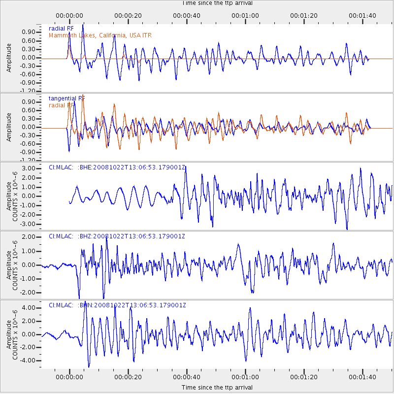
MLAC Mammoth Lakes, California, USA - Earthquake Result Viewer
*The percent match for this event was below the threshold and hence no stack was calculated.
| Earthquake location: |
Tonga Islands |
| Earthquake latitude/longitude: |
-18.4/-175.4 |
| Earthquake time(UTC): |
2008/10/22 (296) 12:55:57 GMT |
| Earthquake Depth: |
233 km |
| Earthquake Magnitude: |
5.9 MB, 6.4 MW, 6.3 MW |
| Earthquake Catalog/Contributor: |
WHDF/NEIC |
|
| Network: |
CI Caltech Regional Seismic Network |
| Station: |
MLAC Mammoth Lakes, California, USA |
| Lat/Lon: |
37.63 N/118.84 W |
| Elevation: |
2134 m |
|
| Distance: |
77.0 deg |
| Az: |
42.812 deg |
| Baz: |
234.36 deg |
| Ray Param: |
$rayparam |
*The percent match for this event was below the threshold and hence was not used in the summary stack. |
|
| Radial Match: |
73.32554 % |
| Radial Bump: |
400 |
| Transverse Match: |
59.68128 % |
| Transverse Bump: |
400 |
| SOD ConfigId: |
2556 |
| Insert Time: |
2010-02-26 00:39:53.011 +0000 |
| GWidth: |
2.5 |
| Max Bumps: |
400 |
| Tol: |
0.001 |
|
Signal To Noise
| Channel | StoN | STA | LTA |
| CI:MLAC: :BHZ:20081022T13:06:53.179001Z | 6.5967045 | 7.9710406E-7 | 1.2083368E-7 |
| CI:MLAC: :BHN:20081022T13:06:53.179001Z | 3.0435452 | 7.7427086E-7 | 2.5439766E-7 |
| CI:MLAC: :BHE:20081022T13:06:53.179001Z | 0.59822446 | 3.7056185E-7 | 6.1943615E-7 |
| Arrivals |
| Ps | |
| PpPs | |
| PsPs/PpSs | |


