MNTX Cornudas Mountains, Texas, USA - Earthquake Result Viewer
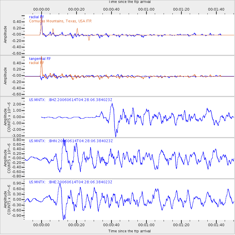
Earthquake location: Rat Islands, Aleutian Islands
Earthquake latitude/longitude: 51.8/177.1
Earthquake time(UTC): 2006/06/14 (165) 04:18:42 GMT
Earthquake Depth: 14 km
Earthquake Magnitude: 5.9 MB, 6.4 MS, 6.4 MW, 6.4 MW
Earthquake Catalog/Contributor: WHDF/NEIC
Network: US United States National Seismic Network
Station: MNTX Cornudas Mountains, Texas, USA
Lat/Lon: 31.70 N/105.38 W
Elevation: 404 m
Distance: 58.4 deg
Az: 77.735 deg
Baz: 314.551 deg
Ray Param: 0.06285852
Estimated Moho Depth: 39.5 km
Estimated Crust Vp/Vs: 1.81
Assumed Crust Vp: 6.361 km/s
Estimated Crust Vs: 3.524 km/s
Estimated Crust Poisson's Ratio: 0.28
Radial Match: 95.68001 %
Radial Bump: 290
Transverse Match: 83.87307 %
Transverse Bump: 400
SOD ConfigId: 5745
Insert Time: 2010-03-05 06:17:51.204 +0000
GWidth: 2.5
Max Bumps: 400
Tol: 0.001

Signal To Noise

ChannelStoNSTALTA
US:MNTX: :BHN:20060614T04:28:06.384023Z1.30508698.633931E-86.615599E-8
US:MNTX: :BHE:20060614T04:28:06.384023Z2.7746051.4956643E-75.3905485E-8
US:MNTX: :BHZ:20060614T04:28:06.384023Z4.7275783.6016664E-77.618418E-8
Arrivals
Ps5.2 SECOND
PpPs17 SECOND
PsPs/PpSs22 SECOND