You are here: Home > Network List > US - United States National Seismic Network Stations List
> Station MNTX Cornudas Mountains, Texas, USA > Earthquake Result Viewer
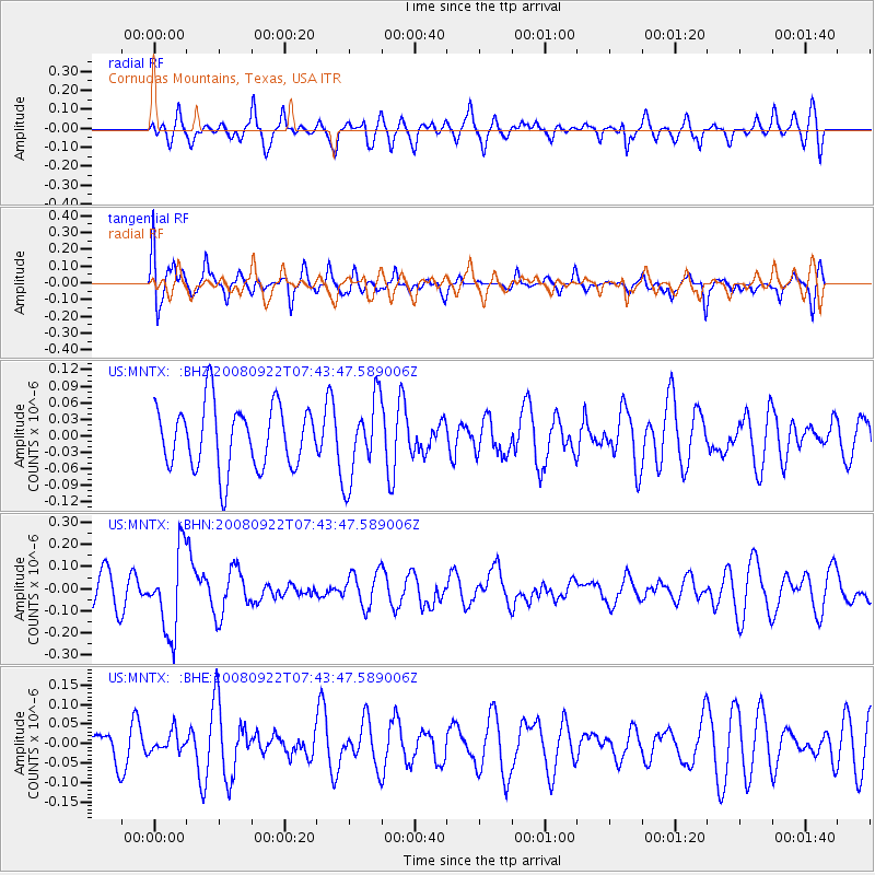
MNTX Cornudas Mountains, Texas, USA - Earthquake Result Viewer
*The percent match for this event was below the threshold and hence no stack was calculated.
| Earthquake location: |
Hokkaido, Japan Region |
| Earthquake latitude/longitude: |
41.6/140.4 |
| Earthquake time(UTC): |
2008/09/22 (266) 07:31:59 GMT |
| Earthquake Depth: |
149 km |
| Earthquake Magnitude: |
5.7 MW, 5.3 MB, 5.6 MW |
| Earthquake Catalog/Contributor: |
WHDF/NEIC |
|
| Network: |
US United States National Seismic Network |
| Station: |
MNTX Cornudas Mountains, Texas, USA |
| Lat/Lon: |
31.70 N/105.38 W |
| Elevation: |
404 m |
|
| Distance: |
85.2 deg |
| Az: |
51.3 deg |
| Baz: |
316.613 deg |
| Ray Param: |
$rayparam |
*The percent match for this event was below the threshold and hence was not used in the summary stack. |
|
| Radial Match: |
47.842236 % |
| Radial Bump: |
400 |
| Transverse Match: |
56.834908 % |
| Transverse Bump: |
400 |
| SOD ConfigId: |
2560 |
| Insert Time: |
2010-03-05 06:18:10.802 +0000 |
| GWidth: |
2.5 |
| Max Bumps: |
400 |
| Tol: |
0.001 |
|
Signal To Noise
| Channel | StoN | STA | LTA |
| US:MNTX: :BHN:20080922T07:43:47.589006Z | 2.487352 | 1.8437116E-7 | 7.412348E-8 |
| US:MNTX: :BHE:20080922T07:43:47.589006Z | 0.41412923 | 2.464712E-8 | 5.951553E-8 |
| US:MNTX: :BHZ:20080922T07:43:47.589006Z | 1.2672081 | 7.250228E-8 | 5.721419E-8 |
| Arrivals |
| Ps | |
| PpPs | |
| PsPs/PpSs | |


