You are here: Home > Network List > US - United States National Seismic Network Stations List
> Station MNTX Cornudas Mountains, Texas, USA > Earthquake Result Viewer
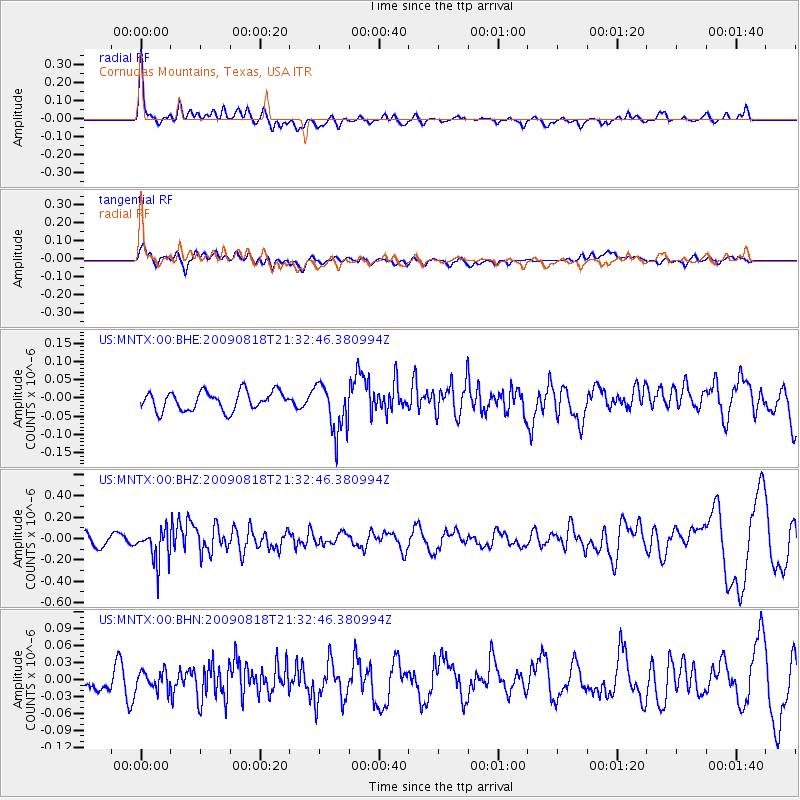
MNTX Cornudas Mountains, Texas, USA - Earthquake Result Viewer
*The percent match for this event was below the threshold and hence no stack was calculated.
| Earthquake location: |
South Of Fiji Islands |
| Earthquake latitude/longitude: |
-26.1/-178.4 |
| Earthquake time(UTC): |
2009/08/18 (230) 21:20:47 GMT |
| Earthquake Depth: |
270 km |
| Earthquake Magnitude: |
5.5 MB, 6.3 MW, 6.3 MW |
| Earthquake Catalog/Contributor: |
WHDF/NEIC |
|
| Network: |
US United States National Seismic Network |
| Station: |
MNTX Cornudas Mountains, Texas, USA |
| Lat/Lon: |
31.70 N/105.38 W |
| Elevation: |
404 m |
|
| Distance: |
90.3 deg |
| Az: |
54.607 deg |
| Baz: |
239.34 deg |
| Ray Param: |
$rayparam |
*The percent match for this event was below the threshold and hence was not used in the summary stack. |
|
| Radial Match: |
76.22333 % |
| Radial Bump: |
351 |
| Transverse Match: |
47.897137 % |
| Transverse Bump: |
400 |
| SOD ConfigId: |
2622 |
| Insert Time: |
2010-03-05 06:18:39.584 +0000 |
| GWidth: |
2.5 |
| Max Bumps: |
400 |
| Tol: |
0.001 |
|
Signal To Noise
| Channel | StoN | STA | LTA |
| US:MNTX:00:BHZ:20090818T21:32:46.380994Z | 2.992066 | 1.5707293E-7 | 5.249648E-8 |
| US:MNTX:00:BHN:20090818T21:32:46.380994Z | 0.6398846 | 1.826158E-8 | 2.8538865E-8 |
| US:MNTX:00:BHE:20090818T21:32:46.380994Z | 2.6557536 | 6.7707326E-8 | 2.549458E-8 |
| Arrivals |
| Ps | |
| PpPs | |
| PsPs/PpSs | |


