You are here: Home > Network List > CI - Caltech Regional Seismic Network Stations List
> Station MUR Murrieta > Earthquake Result Viewer
MUR Murrieta - Earthquake Result Viewer
*The percent match for this event was below the threshold and hence no stack was calculated.
| Earthquake location: |
Southeast Of Honshu, Japan |
| Earthquake latitude/longitude: |
29.9/139.1 |
| Earthquake time(UTC): |
2016/08/22 (235) 09:33:08 GMT |
| Earthquake Depth: |
404 km |
| Earthquake Magnitude: |
5.6 MB |
| Earthquake Catalog/Contributor: |
NEIC PDE/NEIC COMCAT |
|
| Network: |
CI Caltech Regional Seismic Network |
| Station: |
MUR Murrieta |
| Lat/Lon: |
33.60 N/117.20 W |
| Elevation: |
562 m |
|
| Distance: |
84.2 deg |
| Az: |
54.608 deg |
| Baz: |
301.987 deg |
| Ray Param: |
$rayparam |
*The percent match for this event was below the threshold and hence was not used in the summary stack. |
|
| Radial Match: |
53.326168 % |
| Radial Bump: |
400 |
| Transverse Match: |
62.203255 % |
| Transverse Bump: |
400 |
| SOD ConfigId: |
11737051 |
| Insert Time: |
2019-04-25 08:01:28.462 +0000 |
| GWidth: |
2.5 |
| Max Bumps: |
400 |
| Tol: |
0.001 |
|
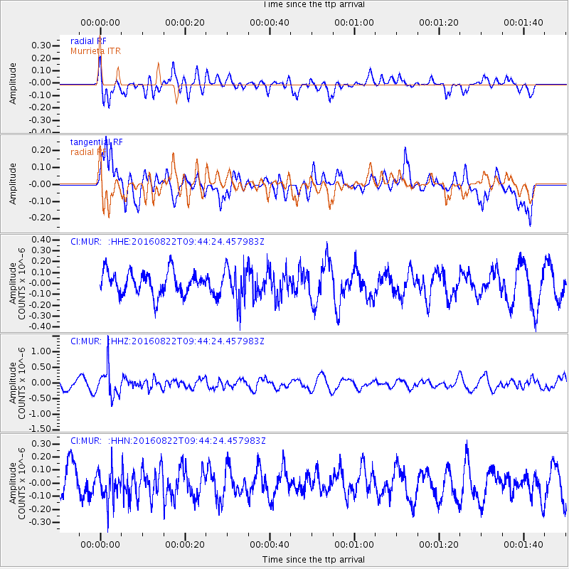
Signal To Noise
| Channel | StoN | STA | LTA |
| CI:MUR: :HHZ:20160822T09:44:24.457983Z | 3.4296756 | 4.451651E-7 | 1.2979802E-7 |
| CI:MUR: :HHN:20160822T09:44:24.457983Z | 0.6894452 | 1.1579764E-7 | 1.6795772E-7 |
| CI:MUR: :HHE:20160822T09:44:24.457983Z | 1.5304581 | 1.584566E-7 | 1.03535406E-7 |
| Arrivals |
| Ps | |
| PpPs | |
| PsPs/PpSs | |


