You are here: Home > Network List > US - United States National Seismic Network Stations List
> Station MNTX Cornudas Mountains, Texas, USA > Earthquake Result Viewer
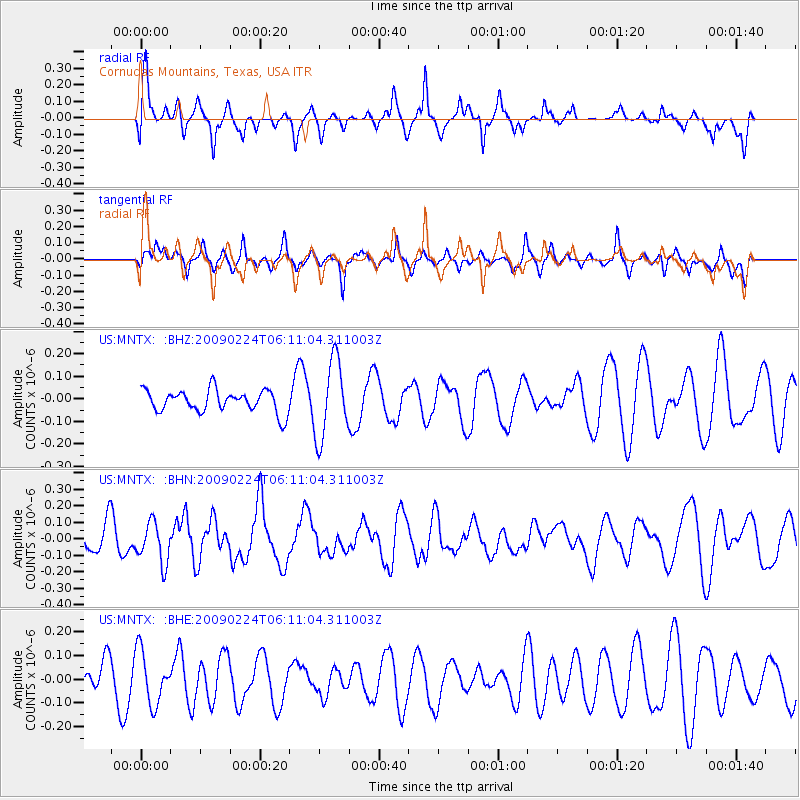
MNTX Cornudas Mountains, Texas, USA - Earthquake Result Viewer
*The percent match for this event was below the threshold and hence no stack was calculated.
| Earthquake location: |
South Of Mariana Islands |
| Earthquake latitude/longitude: |
13.8/146.3 |
| Earthquake time(UTC): |
2009/02/24 (055) 05:57:59 GMT |
| Earthquake Depth: |
5.0 km |
| Earthquake Magnitude: |
5.7 MB, 5.7 MS, 5.9 MW, 5.8 MW |
| Earthquake Catalog/Contributor: |
WHDF/NEIC |
|
| Network: |
US United States National Seismic Network |
| Station: |
MNTX Cornudas Mountains, Texas, USA |
| Lat/Lon: |
31.70 N/105.38 W |
| Elevation: |
404 m |
|
| Distance: |
97.8 deg |
| Az: |
54.772 deg |
| Baz: |
291.4 deg |
| Ray Param: |
$rayparam |
*The percent match for this event was below the threshold and hence was not used in the summary stack. |
|
| Radial Match: |
51.274605 % |
| Radial Bump: |
376 |
| Transverse Match: |
48.683384 % |
| Transverse Bump: |
364 |
| SOD ConfigId: |
2658 |
| Insert Time: |
2010-03-05 06:19:01.555 +0000 |
| GWidth: |
2.5 |
| Max Bumps: |
400 |
| Tol: |
0.001 |
|
Signal To Noise
| Channel | StoN | STA | LTA |
| US:MNTX: :BHN:20090224T06:11:04.311003Z | 2.1044114 | 1.2414854E-7 | 5.8994427E-8 |
| US:MNTX: :BHE:20090224T06:11:04.311003Z | 1.7482684 | 1.1159523E-7 | 6.383186E-8 |
| US:MNTX: :BHZ:20090224T06:11:04.311003Z | 3.4784968 | 1.714109E-7 | 4.927729E-8 |
| Arrivals |
| Ps | |
| PpPs | |
| PsPs/PpSs | |


