You are here: Home > Network List > US - United States National Seismic Network Stations List
> Station MNTX Cornudas Mountains, Texas, USA > Earthquake Result Viewer
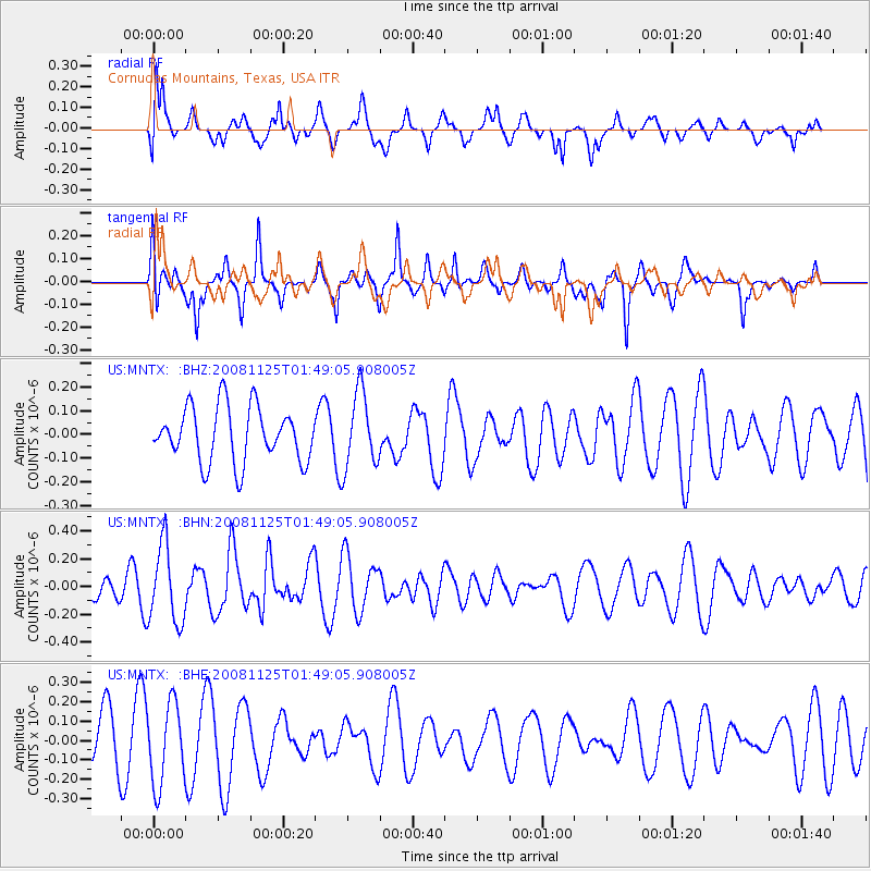
MNTX Cornudas Mountains, Texas, USA - Earthquake Result Viewer
*The percent match for this event was below the threshold and hence no stack was calculated.
| Earthquake location: |
Kermadec Islands, New Zealand |
| Earthquake latitude/longitude: |
-30.2/-177.9 |
| Earthquake time(UTC): |
2008/11/25 (330) 01:36:30 GMT |
| Earthquake Depth: |
35 km |
| Earthquake Magnitude: |
5.6 MB, 5.3 MS, 5.6 MW, 5.6 MW |
| Earthquake Catalog/Contributor: |
WHDF/NEIC |
|
| Network: |
US United States National Seismic Network |
| Station: |
MNTX Cornudas Mountains, Texas, USA |
| Lat/Lon: |
31.70 N/105.38 W |
| Elevation: |
404 m |
|
| Distance: |
92.3 deg |
| Az: |
54.447 deg |
| Baz: |
235.684 deg |
| Ray Param: |
$rayparam |
*The percent match for this event was below the threshold and hence was not used in the summary stack. |
|
| Radial Match: |
57.91497 % |
| Radial Bump: |
400 |
| Transverse Match: |
46.03397 % |
| Transverse Bump: |
317 |
| SOD ConfigId: |
2658 |
| Insert Time: |
2010-03-05 06:19:03.748 +0000 |
| GWidth: |
2.5 |
| Max Bumps: |
400 |
| Tol: |
0.001 |
|
Signal To Noise
| Channel | StoN | STA | LTA |
| US:MNTX: :BHN:20081125T01:49:05.908005Z | 2.1148047 | 2.7901365E-7 | 1.3193353E-7 |
| US:MNTX: :BHE:20081125T01:49:05.908005Z | 2.0574985 | 2.0940334E-7 | 1.017757E-7 |
| US:MNTX: :BHZ:20081125T01:49:05.908005Z | 1.371868 | 1.5878209E-7 | 1.15741514E-7 |
| Arrivals |
| Ps | |
| PpPs | |
| PsPs/PpSs | |


