You are here: Home > Network List > US - United States National Seismic Network Stations List
> Station MNTX Cornudas Mountains, Texas, USA > Earthquake Result Viewer
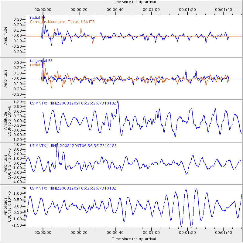
MNTX Cornudas Mountains, Texas, USA - Earthquake Result Viewer
*The percent match for this event was below the threshold and hence no stack was calculated.
| Earthquake location: |
Kermadec Islands Region |
| Earthquake latitude/longitude: |
-31.2/-176.9 |
| Earthquake time(UTC): |
2008/12/09 (344) 06:23:59 GMT |
| Earthquake Depth: |
18 km |
| Earthquake Magnitude: |
6.2 MB, 6.7 MS, 6.8 MW, 6.7 MW |
| Earthquake Catalog/Contributor: |
WHDF/NEIC |
|
| Network: |
US United States National Seismic Network |
| Station: |
MNTX Cornudas Mountains, Texas, USA |
| Lat/Lon: |
31.70 N/105.38 W |
| Elevation: |
404 m |
|
| Distance: |
92.2 deg |
| Az: |
54.013 deg |
| Baz: |
234.405 deg |
| Ray Param: |
$rayparam |
*The percent match for this event was below the threshold and hence was not used in the summary stack. |
|
| Radial Match: |
79.87311 % |
| Radial Bump: |
400 |
| Transverse Match: |
62.113564 % |
| Transverse Bump: |
366 |
| SOD ConfigId: |
2658 |
| Insert Time: |
2010-03-05 06:19:16.667 +0000 |
| GWidth: |
2.5 |
| Max Bumps: |
400 |
| Tol: |
0.001 |
|
Signal To Noise
| Channel | StoN | STA | LTA |
| US:MNTX: :BHN:20081209T06:36:36.731018Z | 1.5456033 | 9.883805E-7 | 6.394788E-7 |
| US:MNTX: :BHE:20081209T06:36:36.731018Z | 0.90300983 | 4.024853E-7 | 4.457153E-7 |
| US:MNTX: :BHZ:20081209T06:36:36.731018Z | 1.2042184 | 4.355768E-7 | 3.617091E-7 |
| Arrivals |
| Ps | |
| PpPs | |
| PsPs/PpSs | |


