You are here: Home > Network List > US - United States National Seismic Network Stations List
> Station MNTX Cornudas Mountains, Texas, USA > Earthquake Result Viewer
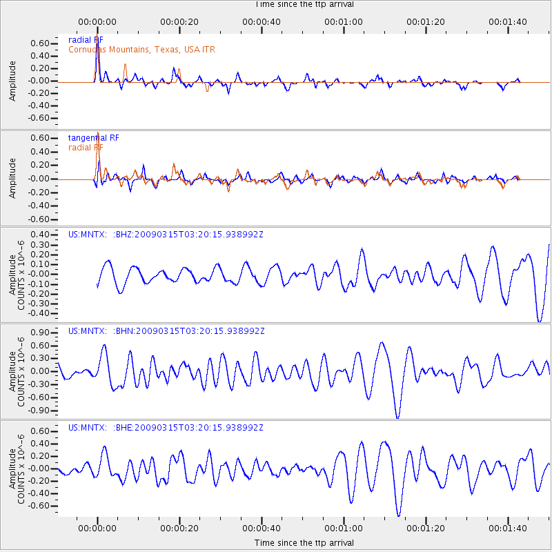
MNTX Cornudas Mountains, Texas, USA - Earthquake Result Viewer
*The percent match for this event was below the threshold and hence no stack was calculated.
| Earthquake location: |
Galapagos Islands Region |
| Earthquake latitude/longitude: |
2.4/-95.1 |
| Earthquake time(UTC): |
2009/03/15 (074) 03:14:31 GMT |
| Earthquake Depth: |
10 km |
| Earthquake Magnitude: |
5.5 MS, 5.4 MB, 5.8 MW, 5.8 MW |
| Earthquake Catalog/Contributor: |
WHDF/NEIC |
|
| Network: |
US United States National Seismic Network |
| Station: |
MNTX Cornudas Mountains, Texas, USA |
| Lat/Lon: |
31.70 N/105.38 W |
| Elevation: |
404 m |
|
| Distance: |
30.7 deg |
| Az: |
342.692 deg |
| Baz: |
159.591 deg |
| Ray Param: |
$rayparam |
*The percent match for this event was below the threshold and hence was not used in the summary stack. |
|
| Radial Match: |
65.996056 % |
| Radial Bump: |
270 |
| Transverse Match: |
66.10925 % |
| Transverse Bump: |
400 |
| SOD ConfigId: |
2658 |
| Insert Time: |
2010-03-05 06:19:17.747 +0000 |
| GWidth: |
2.5 |
| Max Bumps: |
400 |
| Tol: |
0.001 |
|
Signal To Noise
| Channel | StoN | STA | LTA |
| US:MNTX: :BHN:20090315T03:20:15.938992Z | 2.598802 | 3.6379038E-7 | 1.3998387E-7 |
| US:MNTX: :BHE:20090315T03:20:15.938992Z | 3.0932262 | 1.815116E-7 | 5.868035E-8 |
| US:MNTX: :BHZ:20090315T03:20:15.938992Z | 0.93617344 | 7.320587E-8 | 7.819691E-8 |
| Arrivals |
| Ps | |
| PpPs | |
| PsPs/PpSs | |


