You are here: Home > Network List > TA - USArray Transportable Network (new EarthScope stations) Stations List
> Station D23K Nanushuk River, AK USA > Earthquake Result Viewer
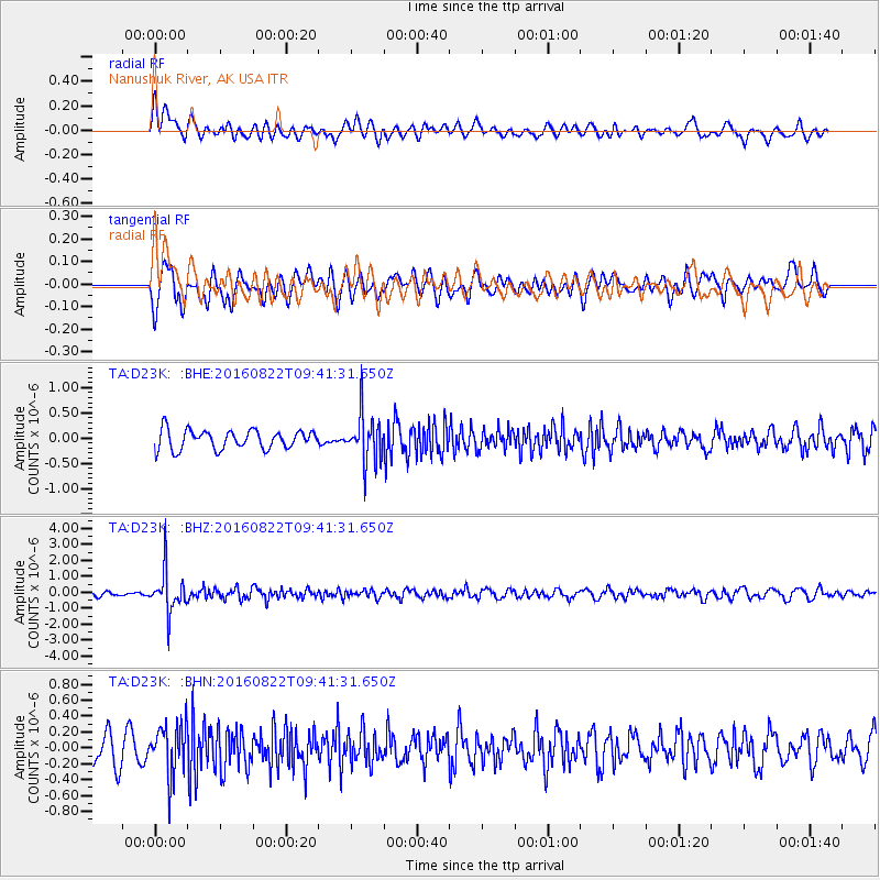
D23K Nanushuk River, AK USA - Earthquake Result Viewer
*The percent match for this event was below the threshold and hence no stack was calculated.
| Earthquake location: |
Southeast Of Honshu, Japan |
| Earthquake latitude/longitude: |
29.9/139.1 |
| Earthquake time(UTC): |
2016/08/22 (235) 09:33:08 GMT |
| Earthquake Depth: |
404 km |
| Earthquake Magnitude: |
5.6 MB |
| Earthquake Catalog/Contributor: |
NEIC PDE/NEIC COMCAT |
|
| Network: |
TA USArray Transportable Network (new EarthScope stations) |
| Station: |
D23K Nanushuk River, AK USA |
| Lat/Lon: |
68.97 N/150.68 W |
| Elevation: |
406 m |
|
| Distance: |
55.3 deg |
| Az: |
24.39 deg |
| Baz: |
263.338 deg |
| Ray Param: |
$rayparam |
*The percent match for this event was below the threshold and hence was not used in the summary stack. |
|
| Radial Match: |
60.04495 % |
| Radial Bump: |
400 |
| Transverse Match: |
56.058704 % |
| Transverse Bump: |
400 |
| SOD ConfigId: |
11737051 |
| Insert Time: |
2019-04-25 08:06:14.819 +0000 |
| GWidth: |
2.5 |
| Max Bumps: |
400 |
| Tol: |
0.001 |
|
Signal To Noise
| Channel | StoN | STA | LTA |
| TA:D23K: :BHZ:20160822T09:41:31.650Z | 7.4950457 | 1.3362244E-6 | 1.7828101E-7 |
| TA:D23K: :BHN:20160822T09:41:31.650Z | 1.5325125 | 3.26322E-7 | 2.129327E-7 |
| TA:D23K: :BHE:20160822T09:41:31.650Z | 2.538707 | 4.786401E-7 | 1.8853697E-7 |
| Arrivals |
| Ps | |
| PpPs | |
| PsPs/PpSs | |


