You are here: Home > Network List > US - United States National Seismic Network Stations List
> Station MNTX Cornudas Mountains, Texas, USA > Earthquake Result Viewer
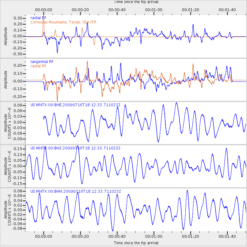
MNTX Cornudas Mountains, Texas, USA - Earthquake Result Viewer
*The percent match for this event was below the threshold and hence no stack was calculated.
| Earthquake location: |
Vanuatu Islands |
| Earthquake latitude/longitude: |
-17.5/167.7 |
| Earthquake time(UTC): |
2009/07/16 (197) 17:59:36 GMT |
| Earthquake Depth: |
10 km |
| Earthquake Magnitude: |
5.8 MW, 5.4 MS, 5.4 MB, 5.8 MW |
| Earthquake Catalog/Contributor: |
WHDF/NEIC |
|
| Network: |
US United States National Seismic Network |
| Station: |
MNTX Cornudas Mountains, Texas, USA |
| Lat/Lon: |
31.70 N/105.38 W |
| Elevation: |
404 m |
|
| Distance: |
96.5 deg |
| Az: |
58.936 deg |
| Baz: |
253.498 deg |
| Ray Param: |
$rayparam |
*The percent match for this event was below the threshold and hence was not used in the summary stack. |
|
| Radial Match: |
58.55721 % |
| Radial Bump: |
400 |
| Transverse Match: |
55.787357 % |
| Transverse Bump: |
400 |
| SOD ConfigId: |
2648 |
| Insert Time: |
2010-03-05 06:19:28.155 +0000 |
| GWidth: |
2.5 |
| Max Bumps: |
400 |
| Tol: |
0.001 |
|
Signal To Noise
| Channel | StoN | STA | LTA |
| US:MNTX:00:BHZ:20090716T18:12:33.711023Z | 1.3287101 | 8.053953E-8 | 6.061482E-8 |
| US:MNTX:00:BHN:20090716T18:12:33.711023Z | 0.6725607 | 2.10901E-8 | 3.1357914E-8 |
| US:MNTX:00:BHE:20090716T18:12:33.711023Z | 1.0807073 | 4.1692115E-8 | 3.8578545E-8 |
| Arrivals |
| Ps | |
| PpPs | |
| PsPs/PpSs | |


