You are here: Home > Network List > TA - USArray Transportable Network (new EarthScope stations) Stations List
> Station G23K Bananza Creek, AK, USA > Earthquake Result Viewer
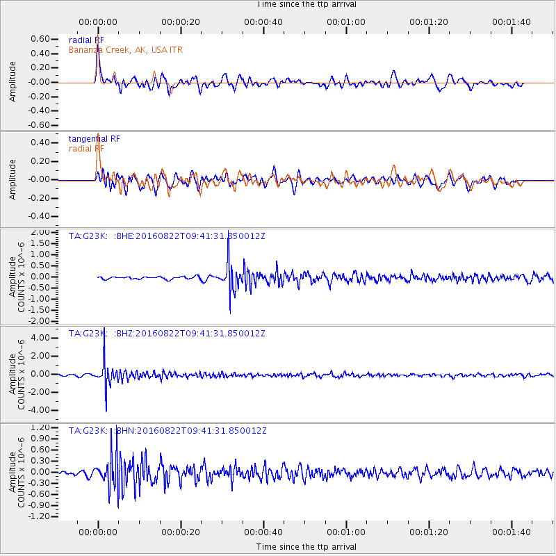
G23K Bananza Creek, AK, USA - Earthquake Result Viewer
*The percent match for this event was below the threshold and hence no stack was calculated.
| Earthquake location: |
Southeast Of Honshu, Japan |
| Earthquake latitude/longitude: |
29.9/139.1 |
| Earthquake time(UTC): |
2016/08/22 (235) 09:33:08 GMT |
| Earthquake Depth: |
404 km |
| Earthquake Magnitude: |
5.6 MB |
| Earthquake Catalog/Contributor: |
NEIC PDE/NEIC COMCAT |
|
| Network: |
TA USArray Transportable Network (new EarthScope stations) |
| Station: |
G23K Bananza Creek, AK, USA |
| Lat/Lon: |
66.71 N/150.02 W |
| Elevation: |
746 m |
|
| Distance: |
55.4 deg |
| Az: |
27.161 deg |
| Baz: |
265.521 deg |
| Ray Param: |
$rayparam |
*The percent match for this event was below the threshold and hence was not used in the summary stack. |
|
| Radial Match: |
79.305565 % |
| Radial Bump: |
400 |
| Transverse Match: |
74.35578 % |
| Transverse Bump: |
400 |
| SOD ConfigId: |
11737051 |
| Insert Time: |
2019-04-25 08:06:29.757 +0000 |
| GWidth: |
2.5 |
| Max Bumps: |
400 |
| Tol: |
0.001 |
|
Signal To Noise
| Channel | StoN | STA | LTA |
| TA:G23K: :BHZ:20160822T09:41:31.850012Z | 12.846475 | 1.3837684E-6 | 1.0771581E-7 |
| TA:G23K: :BHN:20160822T09:41:31.850012Z | 4.5782976 | 4.1220463E-7 | 9.0034476E-8 |
| TA:G23K: :BHE:20160822T09:41:31.850012Z | 11.431563 | 6.2209637E-7 | 5.4419186E-8 |
| Arrivals |
| Ps | |
| PpPs | |
| PsPs/PpSs | |


