You are here: Home > Network List > US - United States National Seismic Network Stations List
> Station MNTX Cornudas Mountains, Texas, USA > Earthquake Result Viewer
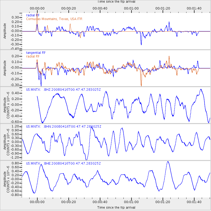
MNTX Cornudas Mountains, Texas, USA - Earthquake Result Viewer
*The percent match for this event was below the threshold and hence no stack was calculated.
| Earthquake location: |
Tonga Islands |
| Earthquake latitude/longitude: |
-18.6/-175.7 |
| Earthquake time(UTC): |
2008/04/16 (107) 00:35:48 GMT |
| Earthquake Depth: |
10 km |
| Earthquake Magnitude: |
5.6 MB, 6.3 MS, 6.3 MW, 6.3 MW |
| Earthquake Catalog/Contributor: |
WHDF/NEIC |
|
| Network: |
US United States National Seismic Network |
| Station: |
MNTX Cornudas Mountains, Texas, USA |
| Lat/Lon: |
31.70 N/105.38 W |
| Elevation: |
404 m |
|
| Distance: |
83.9 deg |
| Az: |
53.821 deg |
| Baz: |
243.903 deg |
| Ray Param: |
$rayparam |
*The percent match for this event was below the threshold and hence was not used in the summary stack. |
|
| Radial Match: |
62.98748 % |
| Radial Bump: |
400 |
| Transverse Match: |
62.00418 % |
| Transverse Bump: |
400 |
| SOD ConfigId: |
2504 |
| Insert Time: |
2010-03-05 06:19:36.480 +0000 |
| GWidth: |
2.5 |
| Max Bumps: |
400 |
| Tol: |
0.001 |
|
Signal To Noise
| Channel | StoN | STA | LTA |
| US:MNTX: :BHN:20080416T00:47:47.283025Z | 1.4044617 | 4.3021228E-7 | 3.0631827E-7 |
| US:MNTX: :BHE:20080416T00:47:47.283025Z | 1.9434413 | 5.0051216E-7 | 2.5753914E-7 |
| US:MNTX: :BHZ:20080416T00:47:47.283025Z | 0.472129 | 1.5290561E-7 | 3.2386404E-7 |
| Arrivals |
| Ps | |
| PpPs | |
| PsPs/PpSs | |


