You are here: Home > Network List > TA - USArray Transportable Network (new EarthScope stations) Stations List
> Station MSTX Muleshoe, TX, USA > Earthquake Result Viewer
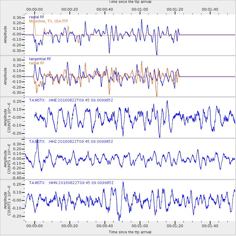
MSTX Muleshoe, TX, USA - Earthquake Result Viewer
*The percent match for this event was below the threshold and hence no stack was calculated.
| Earthquake location: |
Southeast Of Honshu, Japan |
| Earthquake latitude/longitude: |
29.9/139.1 |
| Earthquake time(UTC): |
2016/08/22 (235) 09:33:08 GMT |
| Earthquake Depth: |
404 km |
| Earthquake Magnitude: |
5.6 MB |
| Earthquake Catalog/Contributor: |
NEIC PDE/NEIC COMCAT |
|
| Network: |
TA USArray Transportable Network (new EarthScope stations) |
| Station: |
MSTX Muleshoe, TX, USA |
| Lat/Lon: |
33.97 N/102.77 W |
| Elevation: |
1167 m |
|
| Distance: |
93.7 deg |
| Az: |
47.277 deg |
| Baz: |
309.86 deg |
| Ray Param: |
$rayparam |
*The percent match for this event was below the threshold and hence was not used in the summary stack. |
|
| Radial Match: |
53.939568 % |
| Radial Bump: |
400 |
| Transverse Match: |
53.48369 % |
| Transverse Bump: |
362 |
| SOD ConfigId: |
11737051 |
| Insert Time: |
2019-04-25 08:07:08.787 +0000 |
| GWidth: |
2.5 |
| Max Bumps: |
400 |
| Tol: |
0.001 |
|
Signal To Noise
| Channel | StoN | STA | LTA |
| TA:MSTX: :HHZ:20160822T09:45:09.009985Z | 2.528076 | 1.8441678E-7 | 7.2947486E-8 |
| TA:MSTX: :HHN:20160822T09:45:09.009985Z | 0.68312305 | 6.684383E-8 | 9.785035E-8 |
| TA:MSTX: :HHE:20160822T09:45:09.009985Z | 1.2616327 | 1.0197878E-7 | 8.0830795E-8 |
| Arrivals |
| Ps | |
| PpPs | |
| PsPs/PpSs | |


