You are here: Home > Network List > US - United States National Seismic Network Stations List
> Station MNTX Cornudas Mountains, Texas, USA > Earthquake Result Viewer
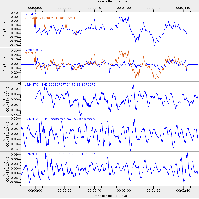
MNTX Cornudas Mountains, Texas, USA - Earthquake Result Viewer
*The percent match for this event was below the threshold and hence no stack was calculated.
| Earthquake location: |
Tonga Islands |
| Earthquake latitude/longitude: |
-16.4/-174.0 |
| Earthquake time(UTC): |
2008/07/07 (189) 04:44:55 GMT |
| Earthquake Depth: |
116 km |
| Earthquake Magnitude: |
5.5 MW, 5.0 MB, 5.5 MW |
| Earthquake Catalog/Contributor: |
WHDF/NEIC |
|
| Network: |
US United States National Seismic Network |
| Station: |
MNTX Cornudas Mountains, Texas, USA |
| Lat/Lon: |
31.70 N/105.38 W |
| Elevation: |
404 m |
|
| Distance: |
81.3 deg |
| Az: |
53.432 deg |
| Baz: |
244.721 deg |
| Ray Param: |
$rayparam |
*The percent match for this event was below the threshold and hence was not used in the summary stack. |
|
| Radial Match: |
38.99801 % |
| Radial Bump: |
400 |
| Transverse Match: |
33.201313 % |
| Transverse Bump: |
400 |
| SOD ConfigId: |
2504 |
| Insert Time: |
2010-03-05 06:19:46.347 +0000 |
| GWidth: |
2.5 |
| Max Bumps: |
400 |
| Tol: |
0.001 |
|
Signal To Noise
| Channel | StoN | STA | LTA |
| US:MNTX: :BHN:20080707T04:56:28.197007Z | 1.5484514 | 6.4153156E-8 | 4.1430525E-8 |
| US:MNTX: :BHE:20080707T04:56:28.197007Z | 1.3349161 | 5.175753E-8 | 3.877212E-8 |
| US:MNTX: :BHZ:20080707T04:56:28.197007Z | 2.324293 | 1.0498473E-7 | 4.516846E-8 |
| Arrivals |
| Ps | |
| PpPs | |
| PsPs/PpSs | |


