You are here: Home > Network List > TA - USArray Transportable Network (new EarthScope stations) Stations List
> Station Q24A Divide, CO, USA > Earthquake Result Viewer
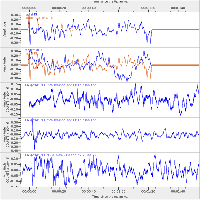
Q24A Divide, CO, USA - Earthquake Result Viewer
*The percent match for this event was below the threshold and hence no stack was calculated.
| Earthquake location: |
Southeast Of Honshu, Japan |
| Earthquake latitude/longitude: |
29.9/139.1 |
| Earthquake time(UTC): |
2016/08/22 (235) 09:33:08 GMT |
| Earthquake Depth: |
404 km |
| Earthquake Magnitude: |
5.6 MB |
| Earthquake Catalog/Contributor: |
NEIC PDE/NEIC COMCAT |
|
| Network: |
TA USArray Transportable Network (new EarthScope stations) |
| Station: |
Q24A Divide, CO, USA |
| Lat/Lon: |
38.96 N/105.15 W |
| Elevation: |
2775 m |
|
| Distance: |
89.0 deg |
| Az: |
44.625 deg |
| Baz: |
308.515 deg |
| Ray Param: |
$rayparam |
*The percent match for this event was below the threshold and hence was not used in the summary stack. |
|
| Radial Match: |
52.60038 % |
| Radial Bump: |
400 |
| Transverse Match: |
42.60029 % |
| Transverse Bump: |
400 |
| SOD ConfigId: |
11737051 |
| Insert Time: |
2019-04-25 08:07:36.637 +0000 |
| GWidth: |
2.5 |
| Max Bumps: |
400 |
| Tol: |
0.001 |
|
Signal To Noise
| Channel | StoN | STA | LTA |
| TA:Q24A: :HHZ:20160822T09:44:47.730017Z | 3.0469453 | 1.4178518E-7 | 4.6533547E-8 |
| TA:Q24A: :HHN:20160822T09:44:47.730017Z | 1.8657186 | 6.638389E-8 | 3.558087E-8 |
| TA:Q24A: :HHE:20160822T09:44:47.730017Z | 1.0446978 | 4.450475E-8 | 4.2600597E-8 |
| Arrivals |
| Ps | |
| PpPs | |
| PsPs/PpSs | |


