You are here: Home > Network List > UW - Pacific Northwest Regional Seismic Network Stations List
> Station LEBA Lebam, WA, USA > Earthquake Result Viewer
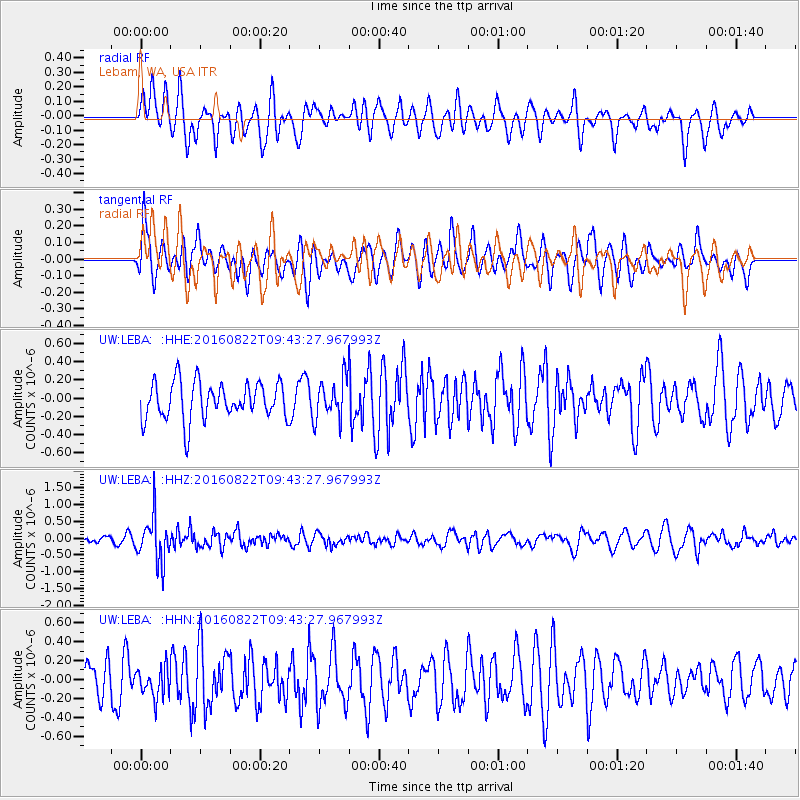
LEBA Lebam, WA, USA - Earthquake Result Viewer
*The percent match for this event was below the threshold and hence no stack was calculated.
| Earthquake location: |
Southeast Of Honshu, Japan |
| Earthquake latitude/longitude: |
29.9/139.1 |
| Earthquake time(UTC): |
2016/08/22 (235) 09:33:08 GMT |
| Earthquake Depth: |
404 km |
| Earthquake Magnitude: |
5.6 MB |
| Earthquake Catalog/Contributor: |
NEIC PDE/NEIC COMCAT |
|
| Network: |
UW Pacific Northwest Regional Seismic Network |
| Station: |
LEBA Lebam, WA, USA |
| Lat/Lon: |
46.55 N/123.56 W |
| Elevation: |
73 m |
|
| Distance: |
73.6 deg |
| Az: |
45.537 deg |
| Baz: |
296.113 deg |
| Ray Param: |
$rayparam |
*The percent match for this event was below the threshold and hence was not used in the summary stack. |
|
| Radial Match: |
57.37768 % |
| Radial Bump: |
400 |
| Transverse Match: |
56.239914 % |
| Transverse Bump: |
400 |
| SOD ConfigId: |
11737051 |
| Insert Time: |
2019-04-25 08:08:23.713 +0000 |
| GWidth: |
2.5 |
| Max Bumps: |
400 |
| Tol: |
0.001 |
|
Signal To Noise
| Channel | StoN | STA | LTA |
| UW:LEBA: :HHZ:20160822T09:43:27.967993Z | 4.6719823 | 6.732172E-7 | 1.4409669E-7 |
| UW:LEBA: :HHN:20160822T09:43:27.967993Z | 0.7142109 | 1.5805836E-7 | 2.2130489E-7 |
| UW:LEBA: :HHE:20160822T09:43:27.967993Z | 1.0748423 | 2.1979497E-7 | 2.0449042E-7 |
| Arrivals |
| Ps | |
| PpPs | |
| PsPs/PpSs | |


