You are here: Home > Network List > TA - USArray Transportable Network (new EarthScope stations) Stations List
> Station D23K Nanushuk River, AK USA > Earthquake Result Viewer
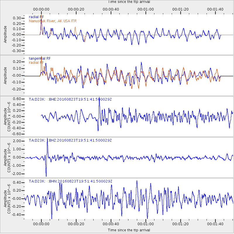
D23K Nanushuk River, AK USA - Earthquake Result Viewer
*The percent match for this event was below the threshold and hence no stack was calculated.
| Earthquake location: |
Flores Sea |
| Earthquake latitude/longitude: |
-7.3/122.5 |
| Earthquake time(UTC): |
2016/08/23 (236) 19:39:44 GMT |
| Earthquake Depth: |
528 km |
| Earthquake Magnitude: |
6.0 MB |
| Earthquake Catalog/Contributor: |
NEIC PDE/NEIC COMCAT |
|
| Network: |
TA USArray Transportable Network (new EarthScope stations) |
| Station: |
D23K Nanushuk River, AK USA |
| Lat/Lon: |
68.97 N/150.68 W |
| Elevation: |
406 m |
|
| Distance: |
95.6 deg |
| Az: |
21.237 deg |
| Baz: |
264.464 deg |
| Ray Param: |
$rayparam |
*The percent match for this event was below the threshold and hence was not used in the summary stack. |
|
| Radial Match: |
63.1065 % |
| Radial Bump: |
400 |
| Transverse Match: |
50.147926 % |
| Transverse Bump: |
400 |
| SOD ConfigId: |
11737051 |
| Insert Time: |
2019-04-25 08:14:36.758 +0000 |
| GWidth: |
2.5 |
| Max Bumps: |
400 |
| Tol: |
0.001 |
|
Signal To Noise
| Channel | StoN | STA | LTA |
| TA:D23K: :BHZ:20160823T19:51:41.500029Z | 7.714214 | 8.169556E-7 | 1.05902636E-7 |
| TA:D23K: :BHN:20160823T19:51:41.500029Z | 0.97246325 | 1.0941009E-7 | 1.125082E-7 |
| TA:D23K: :BHE:20160823T19:51:41.500029Z | 2.2721014 | 2.3190064E-7 | 1.0206439E-7 |
| Arrivals |
| Ps | |
| PpPs | |
| PsPs/PpSs | |


