You are here: Home > Network List > TA - USArray Transportable Network (new EarthScope stations) Stations List
> Station R17K Ugashik Creek, AK, USA > Earthquake Result Viewer
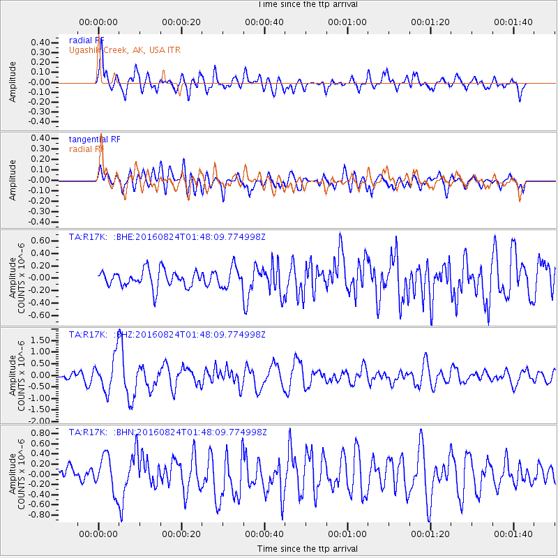
R17K Ugashik Creek, AK, USA - Earthquake Result Viewer
*The percent match for this event was below the threshold and hence no stack was calculated.
| Earthquake location: |
Central Italy |
| Earthquake latitude/longitude: |
42.7/13.2 |
| Earthquake time(UTC): |
2016/08/24 (237) 01:36:33 GMT |
| Earthquake Depth: |
10 km |
| Earthquake Magnitude: |
6.2 MWP |
| Earthquake Catalog/Contributor: |
NEIC PDE/NEIC COMCAT |
|
| Network: |
TA USArray Transportable Network (new EarthScope stations) |
| Station: |
R17K Ugashik Creek, AK, USA |
| Lat/Lon: |
57.64 N/156.39 W |
| Elevation: |
273 m |
|
| Distance: |
79.6 deg |
| Az: |
354.314 deg |
| Baz: |
7.804 deg |
| Ray Param: |
$rayparam |
*The percent match for this event was below the threshold and hence was not used in the summary stack. |
|
| Radial Match: |
59.59857 % |
| Radial Bump: |
400 |
| Transverse Match: |
58.87058 % |
| Transverse Bump: |
400 |
| SOD ConfigId: |
11737051 |
| Insert Time: |
2019-04-25 08:32:30.824 +0000 |
| GWidth: |
2.5 |
| Max Bumps: |
400 |
| Tol: |
0.001 |
|
Signal To Noise
| Channel | StoN | STA | LTA |
| TA:R17K: :BHZ:20160824T01:48:09.774998Z | 4.7020736 | 8.0536034E-7 | 1.712777E-7 |
| TA:R17K: :BHN:20160824T01:48:09.774998Z | 1.7259796 | 3.6720155E-7 | 2.1274964E-7 |
| TA:R17K: :BHE:20160824T01:48:09.774998Z | 1.2360215 | 1.6764086E-7 | 1.356294E-7 |
| Arrivals |
| Ps | |
| PpPs | |
| PsPs/PpSs | |


