You are here: Home > Network List > TA - USArray Transportable Network (new EarthScope stations) Stations List
> Station G21K Allakaket, AK, USA > Earthquake Result Viewer
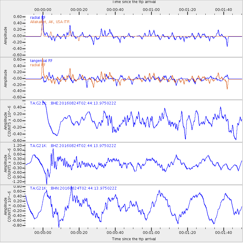
G21K Allakaket, AK, USA - Earthquake Result Viewer
*The percent match for this event was below the threshold and hence no stack was calculated.
| Earthquake location: |
Central Italy |
| Earthquake latitude/longitude: |
42.8/13.1 |
| Earthquake time(UTC): |
2016/08/24 (237) 02:33:30 GMT |
| Earthquake Depth: |
10 km |
| Earthquake Magnitude: |
5.5 MB |
| Earthquake Catalog/Contributor: |
NEIC PDE/NEIC COMCAT |
|
| Network: |
TA USArray Transportable Network (new EarthScope stations) |
| Station: |
G21K Allakaket, AK, USA |
| Lat/Lon: |
66.52 N/153.51 W |
| Elevation: |
446 m |
|
| Distance: |
70.5 deg |
| Az: |
354.359 deg |
| Baz: |
10.396 deg |
| Ray Param: |
$rayparam |
*The percent match for this event was below the threshold and hence was not used in the summary stack. |
|
| Radial Match: |
63.3712 % |
| Radial Bump: |
373 |
| Transverse Match: |
47.742233 % |
| Transverse Bump: |
400 |
| SOD ConfigId: |
11737051 |
| Insert Time: |
2019-04-25 08:42:51.153 +0000 |
| GWidth: |
2.5 |
| Max Bumps: |
400 |
| Tol: |
0.001 |
|
Signal To Noise
| Channel | StoN | STA | LTA |
| TA:G21K: :BHZ:20160824T02:44:13.975022Z | 3.7556126 | 5.935163E-7 | 1.5803448E-7 |
| TA:G21K: :BHN:20160824T02:44:13.975022Z | 1.1146607 | 3.8896468E-7 | 3.4895345E-7 |
| TA:G21K: :BHE:20160824T02:44:13.975022Z | 0.6969429 | 1.6144004E-7 | 2.3164024E-7 |
| Arrivals |
| Ps | |
| PpPs | |
| PsPs/PpSs | |


