You are here: Home > Network List > TA - USArray Transportable Network (new EarthScope stations) Stations List
> Station L44A Lake County Forest Preserve, Grayslake, IL, USA > Earthquake Result Viewer
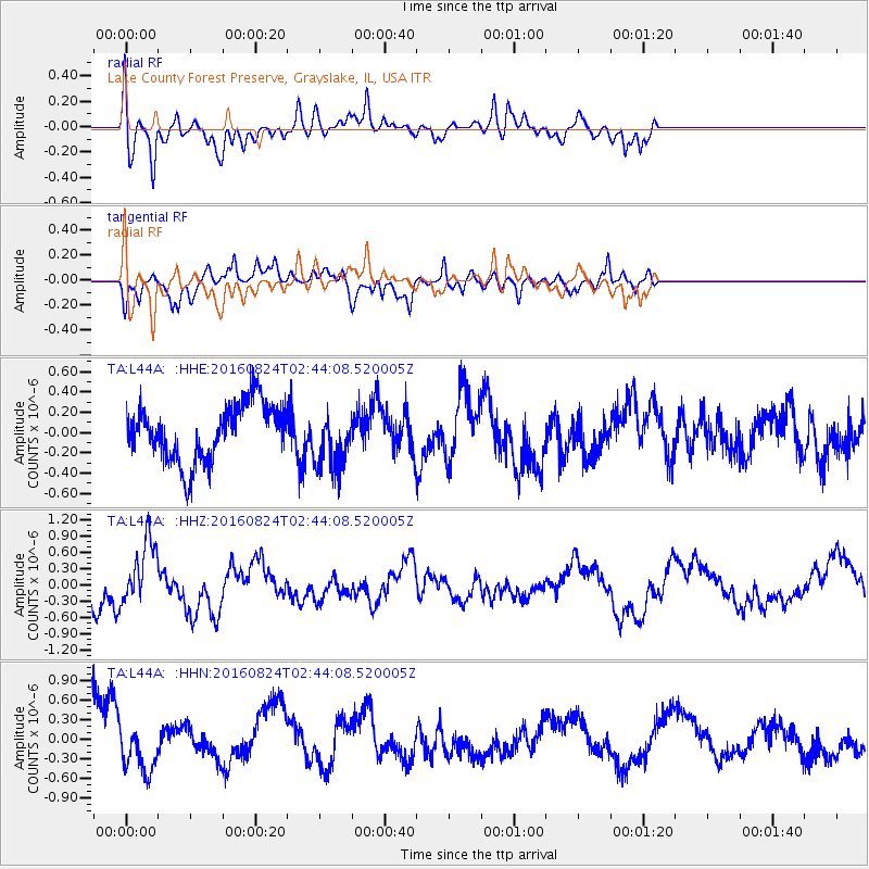
L44A Lake County Forest Preserve, Grayslake, IL, USA - Earthquake Result Viewer
*The percent match for this event was below the threshold and hence no stack was calculated.
| Earthquake location: |
Central Italy |
| Earthquake latitude/longitude: |
42.8/13.1 |
| Earthquake time(UTC): |
2016/08/24 (237) 02:33:30 GMT |
| Earthquake Depth: |
10 km |
| Earthquake Magnitude: |
5.5 MB |
| Earthquake Catalog/Contributor: |
NEIC PDE/NEIC COMCAT |
|
| Network: |
TA USArray Transportable Network (new EarthScope stations) |
| Station: |
L44A Lake County Forest Preserve, Grayslake, IL, USA |
| Lat/Lon: |
42.18 N/87.91 W |
| Elevation: |
202 m |
|
| Distance: |
69.6 deg |
| Az: |
308.895 deg |
| Baz: |
50.388 deg |
| Ray Param: |
$rayparam |
*The percent match for this event was below the threshold and hence was not used in the summary stack. |
|
| Radial Match: |
78.79331 % |
| Radial Bump: |
400 |
| Transverse Match: |
54.863735 % |
| Transverse Bump: |
400 |
| SOD ConfigId: |
11737051 |
| Insert Time: |
2019-04-25 08:43:03.095 +0000 |
| GWidth: |
2.5 |
| Max Bumps: |
400 |
| Tol: |
0.001 |
|
Signal To Noise
| Channel | StoN | STA | LTA |
| TA:L44A: :HHZ:20160824T02:44:08.520005Z | 3.490733 | 5.83488E-7 | 1.6715343E-7 |
| TA:L44A: :HHN:20160824T02:44:08.520005Z | 0.96456444 | 3.525003E-7 | 3.6545023E-7 |
| TA:L44A: :HHE:20160824T02:44:08.520005Z | 0.9899195 | 2.7588638E-7 | 2.7869578E-7 |
| Arrivals |
| Ps | |
| PpPs | |
| PsPs/PpSs | |


