You are here: Home > Network List > TA - USArray Transportable Network (new EarthScope stations) Stations List
> Station M31M Drury Creek, Yukon, CA > Earthquake Result Viewer
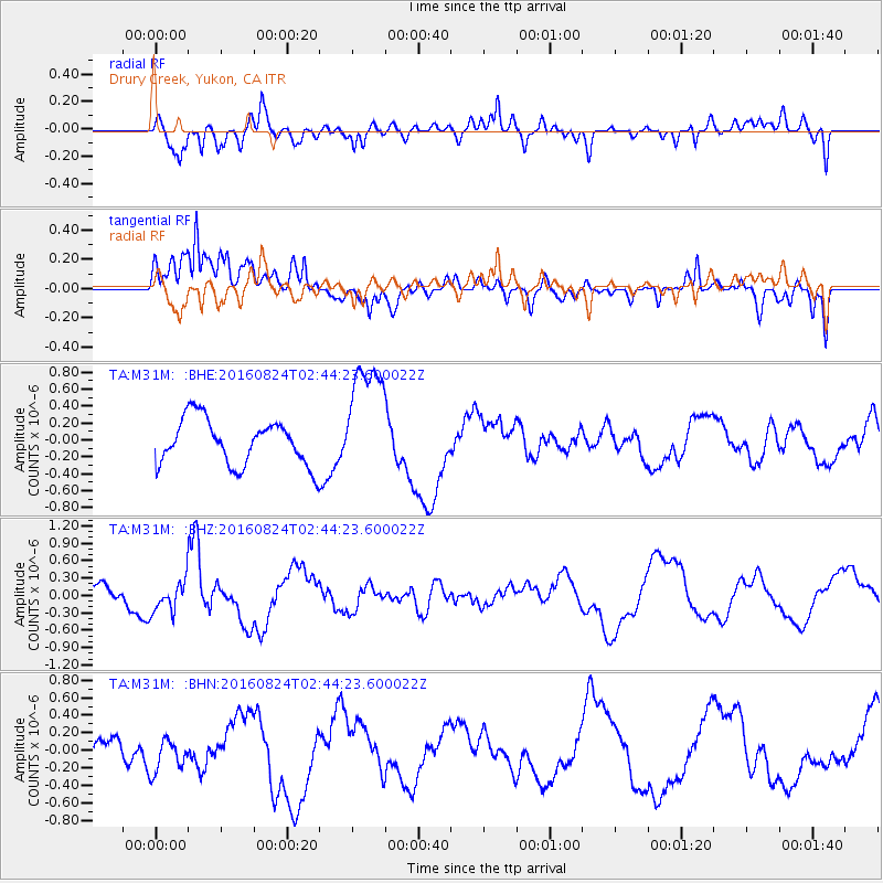
M31M Drury Creek, Yukon, CA - Earthquake Result Viewer
*The percent match for this event was below the threshold and hence no stack was calculated.
| Earthquake location: |
Central Italy |
| Earthquake latitude/longitude: |
42.8/13.1 |
| Earthquake time(UTC): |
2016/08/24 (237) 02:33:30 GMT |
| Earthquake Depth: |
10 km |
| Earthquake Magnitude: |
5.5 MB |
| Earthquake Catalog/Contributor: |
NEIC PDE/NEIC COMCAT |
|
| Network: |
TA USArray Transportable Network (new EarthScope stations) |
| Station: |
M31M Drury Creek, Yukon, CA |
| Lat/Lon: |
62.20 N/134.39 W |
| Elevation: |
639 m |
|
| Distance: |
72.1 deg |
| Az: |
344.658 deg |
| Baz: |
24.533 deg |
| Ray Param: |
$rayparam |
*The percent match for this event was below the threshold and hence was not used in the summary stack. |
|
| Radial Match: |
67.14508 % |
| Radial Bump: |
400 |
| Transverse Match: |
60.029278 % |
| Transverse Bump: |
400 |
| SOD ConfigId: |
11737051 |
| Insert Time: |
2019-04-25 08:43:05.447 +0000 |
| GWidth: |
2.5 |
| Max Bumps: |
400 |
| Tol: |
0.001 |
|
Signal To Noise
| Channel | StoN | STA | LTA |
| TA:M31M: :BHZ:20160824T02:44:23.600022Z | 1.5945127 | 2.6681371E-7 | 1.6733246E-7 |
| TA:M31M: :BHN:20160824T02:44:23.600022Z | 1.3253978 | 1.9430965E-7 | 1.4660476E-7 |
| TA:M31M: :BHE:20160824T02:44:23.600022Z | 2.6843367 | 7.2622345E-7 | 2.7054114E-7 |
| Arrivals |
| Ps | |
| PpPs | |
| PsPs/PpSs | |


