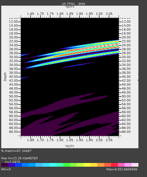
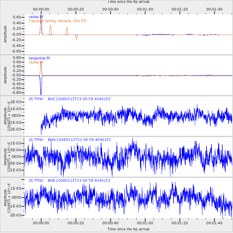
TPNV Topopah Spring, Nevada, USA - Earthquake Result Viewer

Earthquake location: Near Coast Of Chiapas, Mexico
Earthquake latitude/longitude: 14.5/-93.5
Earthquake time(UTC): 2008/03/13 (073) 23:01:18 GMT
Earthquake Depth: 10 km
Earthquake Magnitude: 5.7 MW, 5.0 MS, 5.1 MB, 5.5 MW
Earthquake Catalog/Contributor: WHDF/NEIC
Network: US United States National Seismic Network
Station: TPNV Topopah Spring, Nevada, USA
Lat/Lon: 36.95 N/116.25 W
Elevation: 1600 m
Distance: 30.2 deg
Az: 321.955 deg
Baz: 131.822 deg
Ray Param: 0.07938681
Estimated Moho Depth: 23.25 km
Estimated Crust Vp/Vs: 2.09
Assumed Crust Vp: 6.279 km/s
Estimated Crust Vs: 3.008 km/s
Estimated Crust Poisson's Ratio: 0.35
Radial Match: 97.34697 %
Radial Bump: 71
Transverse Match: 97.8696 %
Transverse Bump: 62
SOD ConfigId: 2564
Insert Time: 2010-03-05 06:26:21.276 +0000
GWidth: 2.5
Max Bumps: 400
Tol: 0.001

Signal To Noise

ChannelStoNSTALTA
US:TPNV: :BHN:20080313T23:06:58.404015Z1.07019484.6941234E-104.3862325E-10
US:TPNV: :BHE:20080313T23:06:58.404015Z0.87471345.713904E-106.532315E-10
US:TPNV: :BHZ:20080313T23:06:58.404015Z0.90907136.252191E-106.8775585E-10
Arrivals
Ps4.3 SECOND
PpPs11 SECOND
PsPs/PpSs15 SECOND