You are here: Home > Network List > US - United States National Seismic Network Stations List
> Station TPNV Topopah Spring, Nevada, USA > Earthquake Result Viewer
TPNV Topopah Spring, Nevada, USA - Earthquake Result Viewer

| Earthquake location: |
Chile-Argentina Border Region |
| Earthquake latitude/longitude: |
-28.3/-69.3 |
| Earthquake time(UTC): |
2008/03/10 (070) 09:43:01 GMT |
| Earthquake Depth: |
90 km |
| Earthquake Magnitude: |
5.6 MB, 5.6 MW |
| Earthquake Catalog/Contributor: |
WHDF/NEIC |
|
| Network: |
US United States National Seismic Network |
| Station: |
TPNV Topopah Spring, Nevada, USA |
| Lat/Lon: |
36.95 N/116.25 W |
| Elevation: |
1600 m |
|
| Distance: |
78.5 deg |
| Az: |
323.311 deg |
| Baz: |
138.897 deg |
| Ray Param: |
0.049403723 |
| Estimated Moho Depth: |
69.75 km |
| Estimated Crust Vp/Vs: |
2.08 |
| Assumed Crust Vp: |
6.279 km/s |
| Estimated Crust Vs: |
3.015 km/s |
| Estimated Crust Poisson's Ratio: |
0.35 |
|
| Radial Match: |
97.10112 % |
| Radial Bump: |
79 |
| Transverse Match: |
98.53409 % |
| Transverse Bump: |
66 |
| SOD ConfigId: |
2564 |
| Insert Time: |
2010-03-05 06:26:22.559 +0000 |
| GWidth: |
2.5 |
| Max Bumps: |
400 |
| Tol: |
0.001 |
|
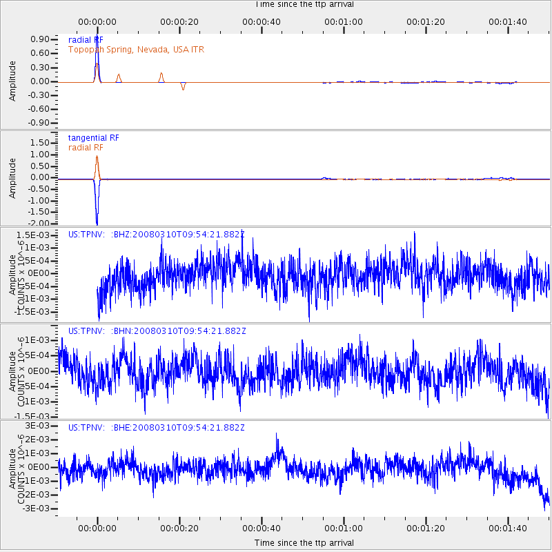
Signal To Noise
| Channel | StoN | STA | LTA |
| US:TPNV: :BHN:20080310T09:54:21.882Z | 1.1085173 | 4.4904525E-10 | 4.0508638E-10 |
| US:TPNV: :BHE:20080310T09:54:21.882Z | 1.0212249 | 5.5609584E-10 | 5.445381E-10 |
| US:TPNV: :BHZ:20080310T09:54:21.882Z | 1.3740994 | 6.738795E-10 | 4.904154E-10 |
| Arrivals |
| Ps | 12 SECOND |
| PpPs | 33 SECOND |
| PsPs/PpSs | 46 SECOND |


