You are here: Home > Network List > US - United States National Seismic Network Stations List
> Station TPNV Topopah Spring, Nevada, USA > Earthquake Result Viewer
TPNV Topopah Spring, Nevada, USA - Earthquake Result Viewer

| Earthquake location: |
Northern Chile |
| Earthquake latitude/longitude: |
-20.3/-69.9 |
| Earthquake time(UTC): |
2008/03/01 (061) 19:51:59 GMT |
| Earthquake Depth: |
37 km |
| Earthquake Magnitude: |
5.7 MB, 5.1 MS, 5.7 MW, 5.6 MW |
| Earthquake Catalog/Contributor: |
WHDF/NEIC |
|
| Network: |
US United States National Seismic Network |
| Station: |
TPNV Topopah Spring, Nevada, USA |
| Lat/Lon: |
36.95 N/116.25 W |
| Elevation: |
1600 m |
|
| Distance: |
71.7 deg |
| Az: |
322.409 deg |
| Baz: |
134.36 deg |
| Ray Param: |
0.05407774 |
| Estimated Moho Depth: |
30.25 km |
| Estimated Crust Vp/Vs: |
1.88 |
| Assumed Crust Vp: |
6.279 km/s |
| Estimated Crust Vs: |
3.335 km/s |
| Estimated Crust Poisson's Ratio: |
0.30 |
|
| Radial Match: |
97.48271 % |
| Radial Bump: |
65 |
| Transverse Match: |
98.31223 % |
| Transverse Bump: |
65 |
| SOD ConfigId: |
2564 |
| Insert Time: |
2010-03-05 06:26:23.873 +0000 |
| GWidth: |
2.5 |
| Max Bumps: |
400 |
| Tol: |
0.001 |
|
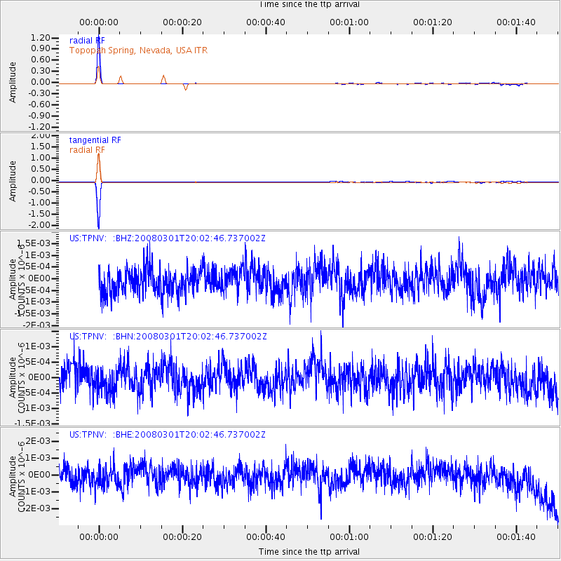
Signal To Noise
| Channel | StoN | STA | LTA |
| US:TPNV: :BHN:20080301T20:02:46.737002Z | 1.0293185 | 4.045504E-10 | 3.9302744E-10 |
| US:TPNV: :BHE:20080301T20:02:46.737002Z | 1.16263 | 5.8605076E-10 | 5.0407334E-10 |
| US:TPNV: :BHZ:20080301T20:02:46.737002Z | 0.9260757 | 4.7834303E-10 | 5.165269E-10 |
| Arrivals |
| Ps | 4.4 SECOND |
| PpPs | 13 SECOND |
| PsPs/PpSs | 18 SECOND |


