You are here: Home > Network List > CN - Canadian National Seismograph Network Stations List
> Station FRB IQALUIT, N.W.T. > Earthquake Result Viewer
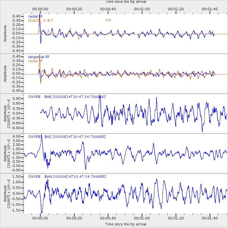
FRB IQALUIT, N.W.T. - Earthquake Result Viewer
*The percent match for this event was below the threshold and hence no stack was calculated.
| Earthquake location: |
Myanmar |
| Earthquake latitude/longitude: |
20.9/94.6 |
| Earthquake time(UTC): |
2016/08/24 (237) 10:34:55 GMT |
| Earthquake Depth: |
84 km |
| Earthquake Magnitude: |
6.8 MO |
| Earthquake Catalog/Contributor: |
NEIC PDE/NEIC ALERT |
|
| Network: |
CN Canadian National Seismograph Network |
| Station: |
FRB IQALUIT, N.W.T. |
| Lat/Lon: |
63.75 N/68.55 W |
| Elevation: |
18 m |
|
| Distance: |
94.6 deg |
| Az: |
352.559 deg |
| Baz: |
15.798 deg |
| Ray Param: |
$rayparam |
*The percent match for this event was below the threshold and hence was not used in the summary stack. |
|
| Radial Match: |
67.39693 % |
| Radial Bump: |
400 |
| Transverse Match: |
55.978065 % |
| Transverse Bump: |
400 |
| SOD ConfigId: |
11737051 |
| Insert Time: |
2019-04-25 08:48:43.452 +0000 |
| GWidth: |
2.5 |
| Max Bumps: |
400 |
| Tol: |
0.001 |
|
Signal To Noise
| Channel | StoN | STA | LTA |
| CN:FRB: :BHZ:20160824T10:47:34.799988Z | 4.1524935 | 2.0901548E-6 | 5.033494E-7 |
| CN:FRB: :BHN:20160824T10:47:34.799988Z | 2.0791435 | 8.807103E-7 | 4.2359284E-7 |
| CN:FRB: :BHE:20160824T10:47:34.799988Z | 1.9258375 | 4.0107602E-7 | 2.0826057E-7 |
| Arrivals |
| Ps | |
| PpPs | |
| PsPs/PpSs | |


