
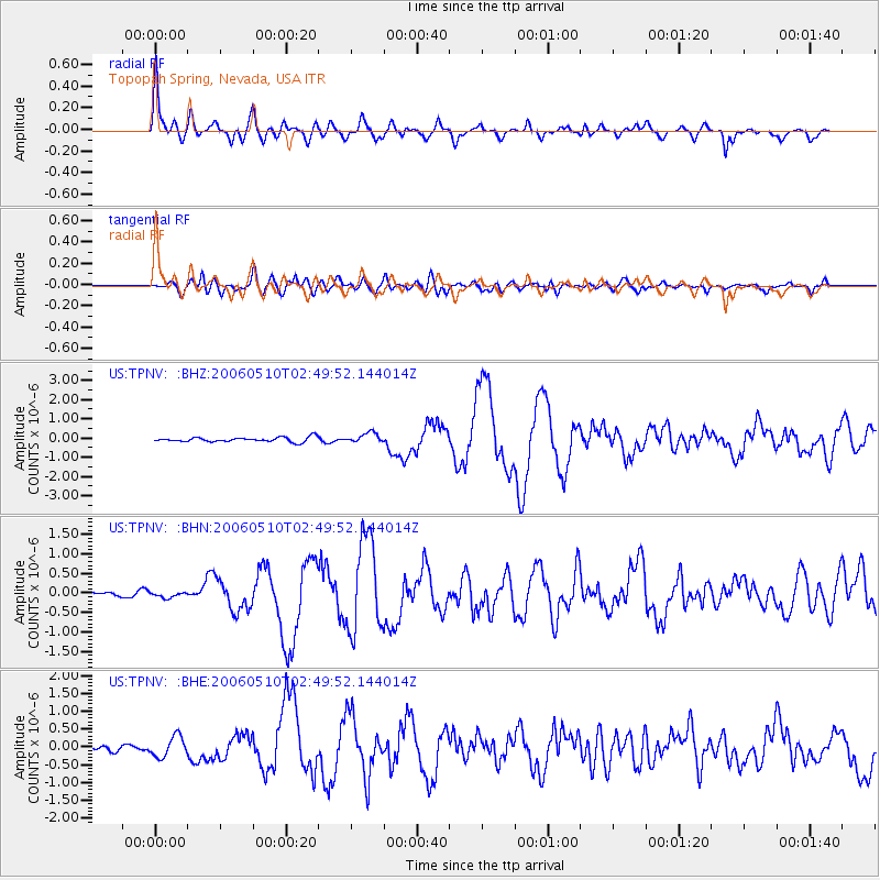
TPNV Topopah Spring, Nevada, USA - Earthquake Result Viewer
| ||||||||||||||||||
| ||||||||||||||||||
| ||||||||||||||||||
|
Signal To Noise
| Channel | StoN | STA | LTA |
| US:TPNV: :BHN:20060510T02:49:52.144014Z | 0.46787697 | 6.528373E-8 | 1.3953182E-7 |
| US:TPNV: :BHE:20060510T02:49:52.144014Z | 1.5041431 | 2.8834404E-7 | 1.9169988E-7 |
| US:TPNV: :BHZ:20060510T02:49:52.144014Z | 2.1523776 | 2.5757836E-7 | 1.1967155E-7 |
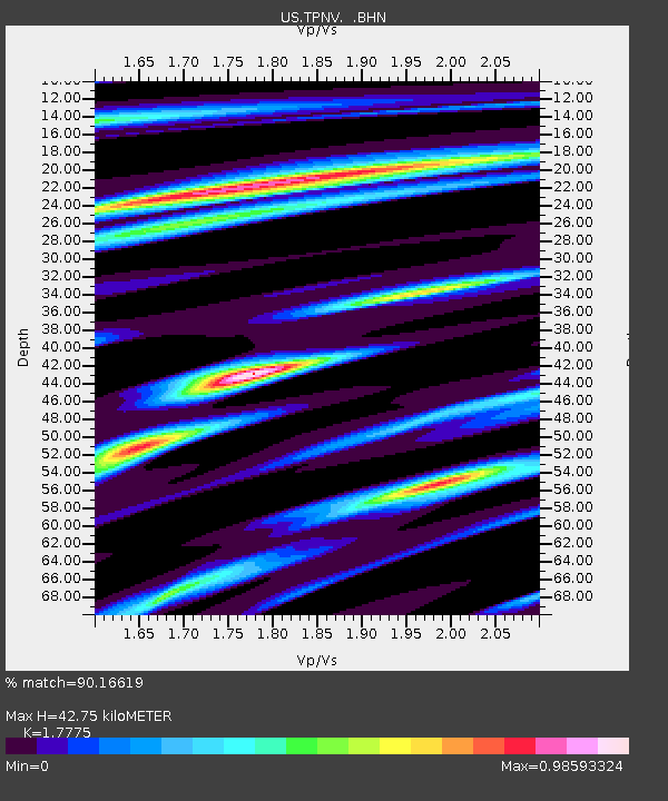
| Arrivals | |
| Ps | 5.7 SECOND |
| PpPs | 18 SECOND |
| PsPs/PpSs | 23 SECOND |

