You are here: Home > Network List > AV - Alaska Volcano Observatory Stations List
> Station SPCR Ckakachatna River, Mount Spurr, Alaska > Earthquake Result Viewer
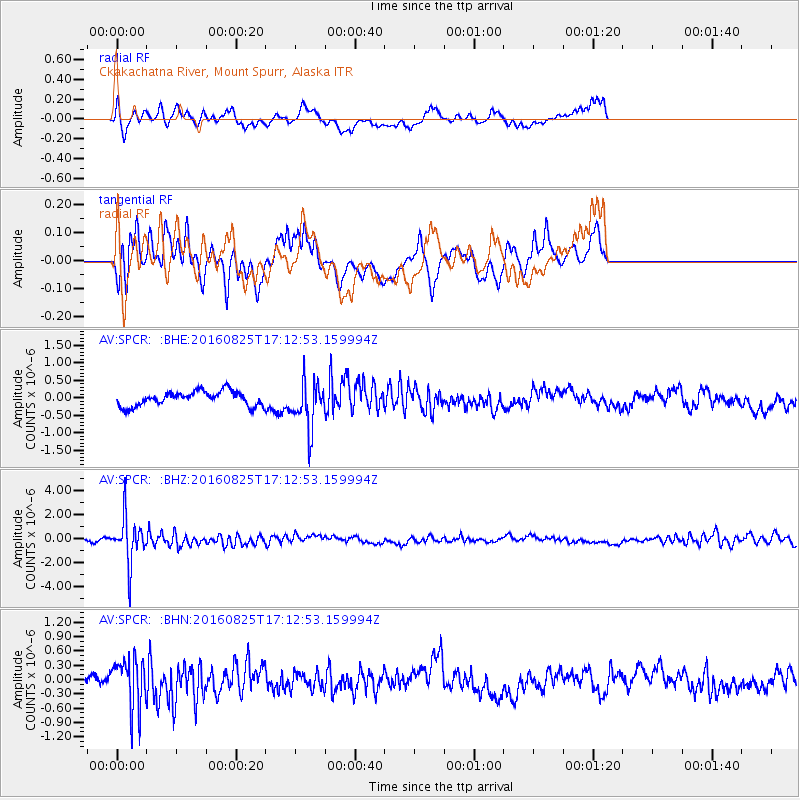
SPCR Ckakachatna River, Mount Spurr, Alaska - Earthquake Result Viewer
*The percent match for this event was below the threshold and hence no stack was calculated.
| Earthquake location: |
Southeast Of Honshu, Japan |
| Earthquake latitude/longitude: |
30.6/137.8 |
| Earthquake time(UTC): |
2016/08/25 (238) 17:04:43 GMT |
| Earthquake Depth: |
456 km |
| Earthquake Magnitude: |
5.9 MWW, 5.9 MWB |
| Earthquake Catalog/Contributor: |
NEIC PDE/NEIC COMCAT |
|
| Network: |
AV Alaska Volcano Observatory |
| Station: |
SPCR Ckakachatna River, Mount Spurr, Alaska |
| Lat/Lon: |
61.20 N/152.21 W |
| Elevation: |
984 m |
|
| Distance: |
54.1 deg |
| Az: |
34.168 deg |
| Baz: |
269.06 deg |
| Ray Param: |
$rayparam |
*The percent match for this event was below the threshold and hence was not used in the summary stack. |
|
| Radial Match: |
60.975967 % |
| Radial Bump: |
400 |
| Transverse Match: |
71.765335 % |
| Transverse Bump: |
337 |
| SOD ConfigId: |
11737051 |
| Insert Time: |
2019-04-25 08:59:52.593 +0000 |
| GWidth: |
2.5 |
| Max Bumps: |
400 |
| Tol: |
0.001 |
|
Signal To Noise
| Channel | StoN | STA | LTA |
| AV:SPCR: :BHZ:20160825T17:12:53.159994Z | 12.269811 | 1.8676847E-6 | 1.522179E-7 |
| AV:SPCR: :BHN:20160825T17:12:53.159994Z | 3.4748328 | 5.276523E-7 | 1.5184969E-7 |
| AV:SPCR: :BHE:20160825T17:12:53.159994Z | 3.1885266 | 6.641748E-7 | 2.0830147E-7 |
| Arrivals |
| Ps | |
| PpPs | |
| PsPs/PpSs | |


