You are here: Home > Network List > CI - Caltech Regional Seismic Network Stations List
> Station MPP McPhearson Peak > Earthquake Result Viewer
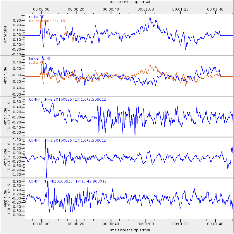
MPP McPhearson Peak - Earthquake Result Viewer
*The percent match for this event was below the threshold and hence no stack was calculated.
| Earthquake location: |
Southeast Of Honshu, Japan |
| Earthquake latitude/longitude: |
30.6/137.8 |
| Earthquake time(UTC): |
2016/08/25 (238) 17:04:43 GMT |
| Earthquake Depth: |
456 km |
| Earthquake Magnitude: |
5.9 MWW, 5.9 MWB |
| Earthquake Catalog/Contributor: |
NEIC PDE/NEIC COMCAT |
|
| Network: |
CI Caltech Regional Seismic Network |
| Station: |
MPP McPhearson Peak |
| Lat/Lon: |
34.89 N/119.81 W |
| Elevation: |
1739 m |
|
| Distance: |
82.1 deg |
| Az: |
54.167 deg |
| Baz: |
301.766 deg |
| Ray Param: |
$rayparam |
*The percent match for this event was below the threshold and hence was not used in the summary stack. |
|
| Radial Match: |
53.407158 % |
| Radial Bump: |
400 |
| Transverse Match: |
57.424217 % |
| Transverse Bump: |
400 |
| SOD ConfigId: |
11737051 |
| Insert Time: |
2019-04-25 09:00:47.403 +0000 |
| GWidth: |
2.5 |
| Max Bumps: |
400 |
| Tol: |
0.001 |
|
Signal To Noise
| Channel | StoN | STA | LTA |
| CI:MPP: :HHZ:20160825T17:15:43.90801Z | 4.3436284 | 4.5970958E-7 | 1.0583538E-7 |
| CI:MPP: :HHN:20160825T17:15:43.90801Z | 2.1099954 | 3.5056283E-7 | 1.6614388E-7 |
| CI:MPP: :HHE:20160825T17:15:43.90801Z | 1.3050685 | 2.5394039E-7 | 1.9458012E-7 |
| Arrivals |
| Ps | |
| PpPs | |
| PsPs/PpSs | |


