You are here: Home > Network List > CN - Canadian National Seismograph Network Stations List
> Station INK INUVIK, NT > Earthquake Result Viewer
INK INUVIK, NT - Earthquake Result Viewer
*The percent match for this event was below the threshold and hence no stack was calculated.
| Earthquake location: |
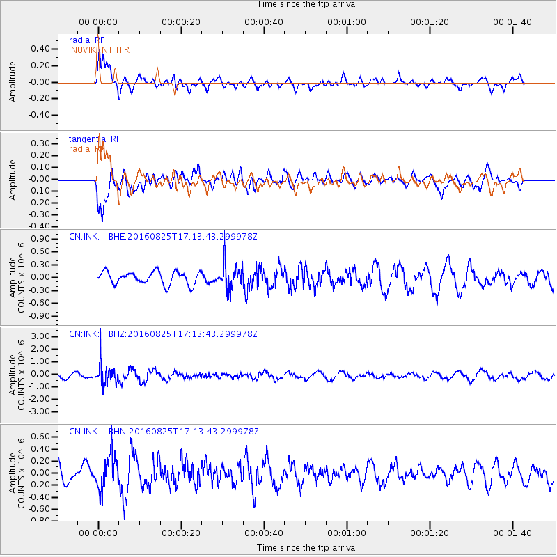
Southeast Of Honshu, Japan |
| Earthquake latitude/longitude: |
30.6/137.8 |
| Earthquake time(UTC): |
2016/08/25 (238) 17:04:43 GMT |
| Earthquake Depth: |
456 km |
| Earthquake Magnitude: |
5.9 MWW, 5.9 MWB |
| Earthquake Catalog/Contributor: |
NEIC PDE/NEIC COMCAT |
|
| Network: |
CN Canadian National Seismograph Network |
| Station: |
INK INUVIK, NT |
| Lat/Lon: |
68.31 N/133.53 W |
| Elevation: |
44 m |
|
| Distance: |
61.4 deg |
| Az: |
25.035 deg |
| Baz: |
281.11 deg |
| Ray Param: |
$rayparam |
*The percent match for this event was below the threshold and hence was not used in the summary stack. |
|
| Radial Match: |
70.8601 % |
| Radial Bump: |
400 |
| Transverse Match: |
74.55868 % |
| Transverse Bump: |
400 |
| SOD ConfigId: |
11737051 |
| Insert Time: |
2019-04-25 09:01:13.784 +0000 |
| GWidth: |
2.5 |
| Max Bumps: |
400 |
| Tol: |
0.001 |
|
Signal To Noise
| Channel | StoN | STA | LTA |
| CN:INK: :BHZ:20160825T17:13:43.299978Z | 3.579364 | 8.222053E-7 | 2.2970708E-7 |
| CN:INK: :BHN:20160825T17:13:43.299978Z | 1.7287132 | 2.8135682E-7 | 1.6275506E-7 |
| CN:INK: :BHE:20160825T17:13:43.299978Z | 1.9958115 | 2.9173245E-7 | 1.4617234E-7 |
| Arrivals |
| Ps | |
| PpPs | |
| PsPs/PpSs | |


