
TPNV Topopah Spring, Nevada, USA - Earthquake Result Viewer
| ||||||||||||||||||
| ||||||||||||||||||
| ||||||||||||||||||
|
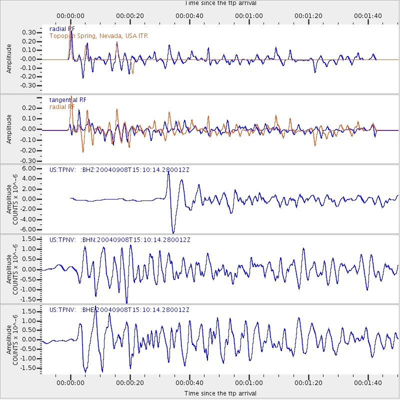
Signal To Noise
| Channel | StoN | STA | LTA |
| US:TPNV: :BHN:20040908T15:10:14.280012Z | 3.8716438 | 4.1864294E-7 | 1.0813054E-7 |
| US:TPNV: :BHE:20040908T15:10:14.280012Z | 6.367128 | 6.2631966E-7 | 9.836769E-8 |
| US:TPNV: :BHZ:20040908T15:10:14.280012Z | 18.489332 | 3.0784197E-6 | 1.6649707E-7 |
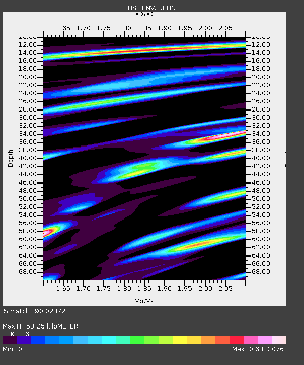
| Arrivals | |
| Ps | 5.7 SECOND |
| PpPs | 23 SECOND |
| PsPs/PpSs | 29 SECOND |

