You are here: Home > Network List > TA - USArray Transportable Network (new EarthScope stations) Stations List
> Station A21K Barrow, AK, USA > Earthquake Result Viewer
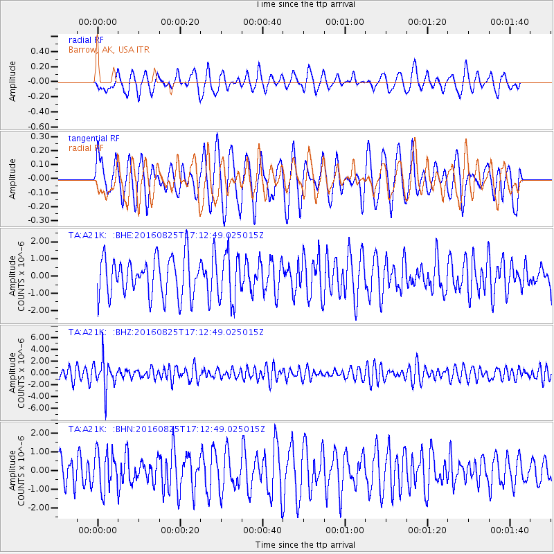
A21K Barrow, AK, USA - Earthquake Result Viewer
*The percent match for this event was below the threshold and hence no stack was calculated.
| Earthquake location: |
Southeast Of Honshu, Japan |
| Earthquake latitude/longitude: |
30.6/137.8 |
| Earthquake time(UTC): |
2016/08/25 (238) 17:04:43 GMT |
| Earthquake Depth: |
456 km |
| Earthquake Magnitude: |
5.9 MWW, 5.9 MWB |
| Earthquake Catalog/Contributor: |
NEIC PDE/NEIC COMCAT |
|
| Network: |
TA USArray Transportable Network (new EarthScope stations) |
| Station: |
A21K Barrow, AK, USA |
| Lat/Lon: |
71.32 N/156.62 W |
| Elevation: |
577 m |
|
| Distance: |
53.5 deg |
| Az: |
21.394 deg |
| Baz: |
257.448 deg |
| Ray Param: |
$rayparam |
*The percent match for this event was below the threshold and hence was not used in the summary stack. |
|
| Radial Match: |
39.64151 % |
| Radial Bump: |
400 |
| Transverse Match: |
52.759735 % |
| Transverse Bump: |
400 |
| SOD ConfigId: |
11737051 |
| Insert Time: |
2019-04-25 09:05:08.775 +0000 |
| GWidth: |
2.5 |
| Max Bumps: |
400 |
| Tol: |
0.001 |
|
Signal To Noise
| Channel | StoN | STA | LTA |
| TA:A21K: :BHZ:20160825T17:12:49.025015Z | 2.8663604 | 2.4331453E-6 | 8.4886227E-7 |
| TA:A21K: :BHN:20160825T17:12:49.025015Z | 1.5563539 | 1.0344077E-6 | 6.646352E-7 |
| TA:A21K: :BHE:20160825T17:12:49.025015Z | 1.1991247 | 1.3522756E-6 | 1.1277189E-6 |
| Arrivals |
| Ps | |
| PpPs | |
| PsPs/PpSs | |


