You are here: Home > Network List > TA - USArray Transportable Network (new EarthScope stations) Stations List
> Station R33M Jennings River, BC, CAN > Earthquake Result Viewer
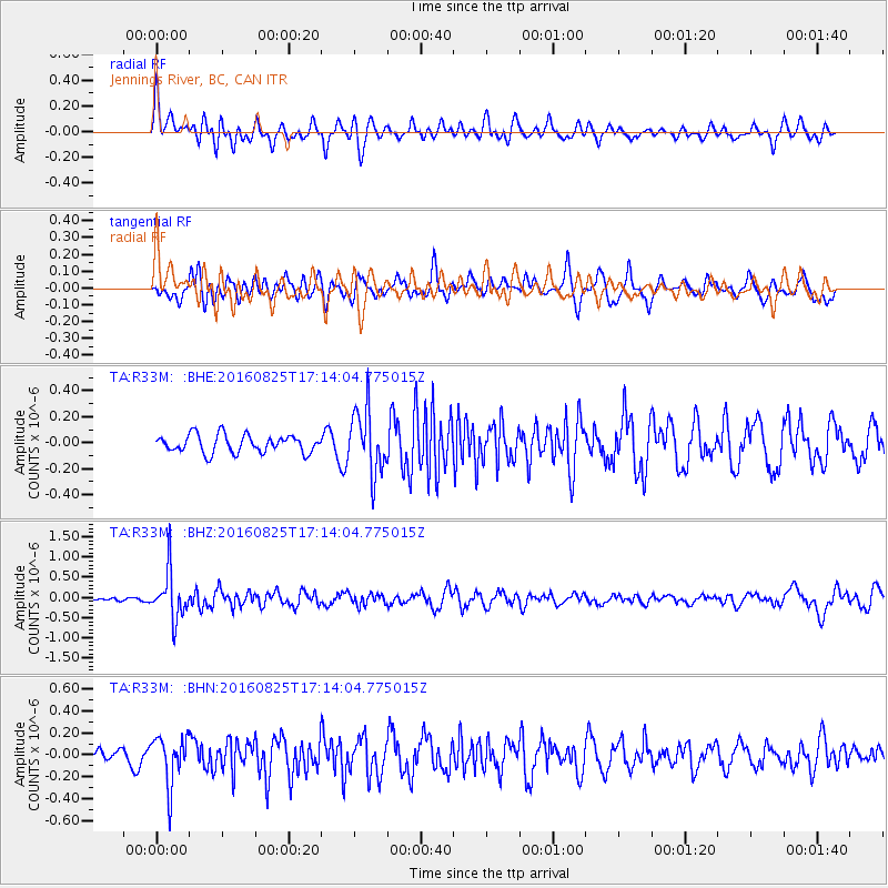
R33M Jennings River, BC, CAN - Earthquake Result Viewer
*The percent match for this event was below the threshold and hence no stack was calculated.
| Earthquake location: |
Southeast Of Honshu, Japan |
| Earthquake latitude/longitude: |
30.6/137.8 |
| Earthquake time(UTC): |
2016/08/25 (238) 17:04:43 GMT |
| Earthquake Depth: |
456 km |
| Earthquake Magnitude: |
5.9 MWW, 5.9 MWB |
| Earthquake Catalog/Contributor: |
NEIC PDE/NEIC COMCAT |
|
| Network: |
TA USArray Transportable Network (new EarthScope stations) |
| Station: |
R33M Jennings River, BC, CAN |
| Lat/Lon: |
59.39 N/130.97 W |
| Elevation: |
1437 m |
|
| Distance: |
64.8 deg |
| Az: |
34.437 deg |
| Baz: |
287.672 deg |
| Ray Param: |
$rayparam |
*The percent match for this event was below the threshold and hence was not used in the summary stack. |
|
| Radial Match: |
62.954113 % |
| Radial Bump: |
400 |
| Transverse Match: |
55.425903 % |
| Transverse Bump: |
400 |
| SOD ConfigId: |
11737051 |
| Insert Time: |
2019-04-25 09:06:35.772 +0000 |
| GWidth: |
2.5 |
| Max Bumps: |
400 |
| Tol: |
0.001 |
|
Signal To Noise
| Channel | StoN | STA | LTA |
| TA:R33M: :BHZ:20160825T17:14:04.775015Z | 6.0193706 | 5.7924865E-7 | 9.6230764E-8 |
| TA:R33M: :BHN:20160825T17:14:04.775015Z | 1.817057 | 2.2307621E-7 | 1.2276786E-7 |
| TA:R33M: :BHE:20160825T17:14:04.775015Z | 3.58655 | 2.4623756E-7 | 6.865583E-8 |
| Arrivals |
| Ps | |
| PpPs | |
| PsPs/PpSs | |


