You are here: Home > Network List > US - United States National Seismic Network Stations List
> Station TZTN Tazewell, Tennessee, USA > Earthquake Result Viewer
TZTN Tazewell, Tennessee, USA - Earthquake Result Viewer

| Earthquake location: |
Iceland |
| Earthquake latitude/longitude: |
64.0/-21.0 |
| Earthquake time(UTC): |
2008/05/29 (150) 15:46:00 GMT |
| Earthquake Depth: |
10 km |
| Earthquake Magnitude: |
6.0 MB, 6.2 MS, 6.3 MW, 6.2 MW |
| Earthquake Catalog/Contributor: |
WHDF/NEIC |
|
| Network: |
US United States National Seismic Network |
| Station: |
TZTN Tazewell, Tennessee, USA |
| Lat/Lon: |
36.54 N/83.55 W |
| Elevation: |
394 m |
|
| Distance: |
45.9 deg |
| Az: |
264.237 deg |
| Baz: |
32.988 deg |
| Ray Param: |
0.07097454 |
| Estimated Moho Depth: |
14.25 km |
| Estimated Crust Vp/Vs: |
1.83 |
| Assumed Crust Vp: |
6.476 km/s |
| Estimated Crust Vs: |
3.539 km/s |
| Estimated Crust Poisson's Ratio: |
0.29 |
|
| Radial Match: |
80.12697 % |
| Radial Bump: |
400 |
| Transverse Match: |
59.063507 % |
| Transverse Bump: |
400 |
| SOD ConfigId: |
2504 |
| Insert Time: |
2010-03-05 06:30:08.322 +0000 |
| GWidth: |
2.5 |
| Max Bumps: |
400 |
| Tol: |
0.001 |
|
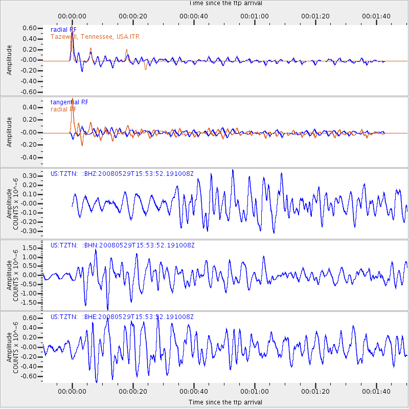
Signal To Noise
| Channel | StoN | STA | LTA |
| US:TZTN: :BHN:20080529T15:53:52.191008Z | 3.5750456 | 5.837893E-7 | 1.6329562E-7 |
| US:TZTN: :BHE:20080529T15:53:52.191008Z | 1.2654018 | 1.5827935E-7 | 1.2508228E-7 |
| US:TZTN: :BHZ:20080529T15:53:52.191008Z | 1.2917485 | 9.022706E-8 | 6.984878E-8 |
| Arrivals |
| Ps | 1.9 SECOND |
| PpPs | 5.9 SECOND |
| PsPs/PpSs | 7.8 SECOND |


