You are here: Home > Network List > TA - USArray Transportable Network (new EarthScope stations) Stations List
> Station V35K Ketchikan, AK, USA > Earthquake Result Viewer
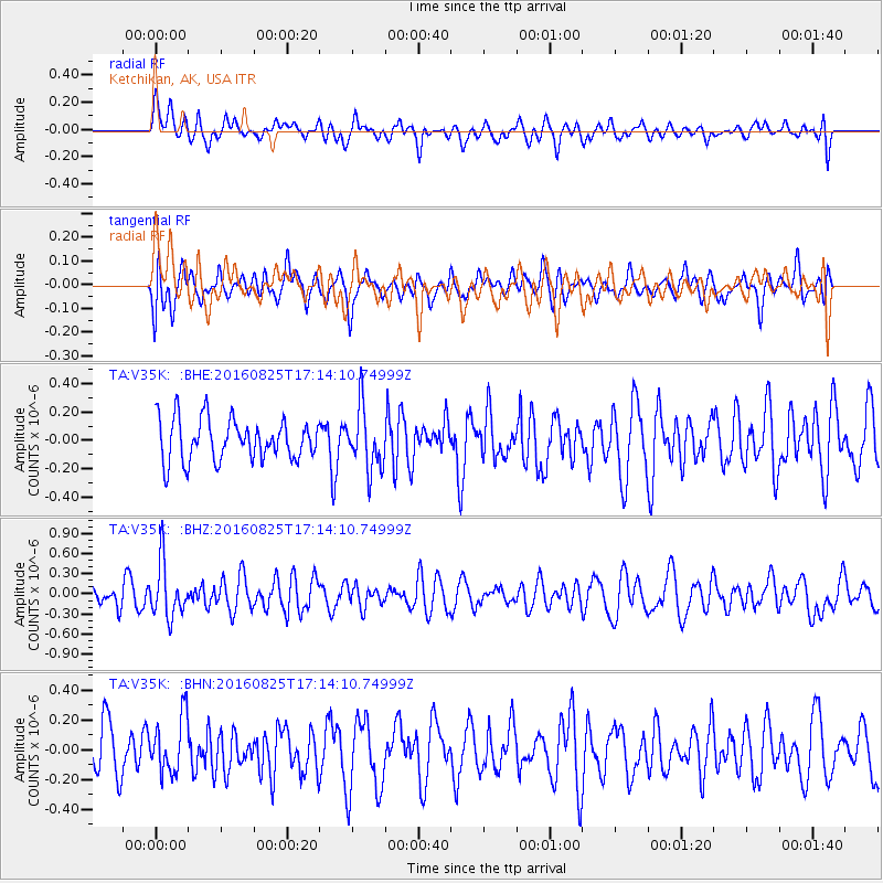
V35K Ketchikan, AK, USA - Earthquake Result Viewer
*The percent match for this event was below the threshold and hence no stack was calculated.
| Earthquake location: |
Southeast Of Honshu, Japan |
| Earthquake latitude/longitude: |
30.6/137.8 |
| Earthquake time(UTC): |
2016/08/25 (238) 17:04:43 GMT |
| Earthquake Depth: |
456 km |
| Earthquake Magnitude: |
5.9 MWW, 5.9 MWB |
| Earthquake Catalog/Contributor: |
NEIC PDE/NEIC COMCAT |
|
| Network: |
TA USArray Transportable Network (new EarthScope stations) |
| Station: |
V35K Ketchikan, AK, USA |
| Lat/Lon: |
55.33 N/131.62 W |
| Elevation: |
64 m |
|
| Distance: |
65.7 deg |
| Az: |
38.821 deg |
| Baz: |
288.964 deg |
| Ray Param: |
$rayparam |
*The percent match for this event was below the threshold and hence was not used in the summary stack. |
|
| Radial Match: |
60.048622 % |
| Radial Bump: |
400 |
| Transverse Match: |
45.663734 % |
| Transverse Bump: |
400 |
| SOD ConfigId: |
11737051 |
| Insert Time: |
2019-04-25 09:06:41.146 +0000 |
| GWidth: |
2.5 |
| Max Bumps: |
400 |
| Tol: |
0.001 |
|
Signal To Noise
| Channel | StoN | STA | LTA |
| TA:V35K: :BHZ:20160825T17:14:10.74999Z | 1.8971466 | 4.0643087E-7 | 2.1423273E-7 |
| TA:V35K: :BHN:20160825T17:14:10.74999Z | 1.1478131 | 1.920482E-7 | 1.6731663E-7 |
| TA:V35K: :BHE:20160825T17:14:10.74999Z | 1.4915198 | 2.1744526E-7 | 1.4578771E-7 |
| Arrivals |
| Ps | |
| PpPs | |
| PsPs/PpSs | |


