You are here: Home > Network List > UW - Pacific Northwest Regional Seismic Network Stations List
> Station PASS Maple Falls, WA, USA > Earthquake Result Viewer
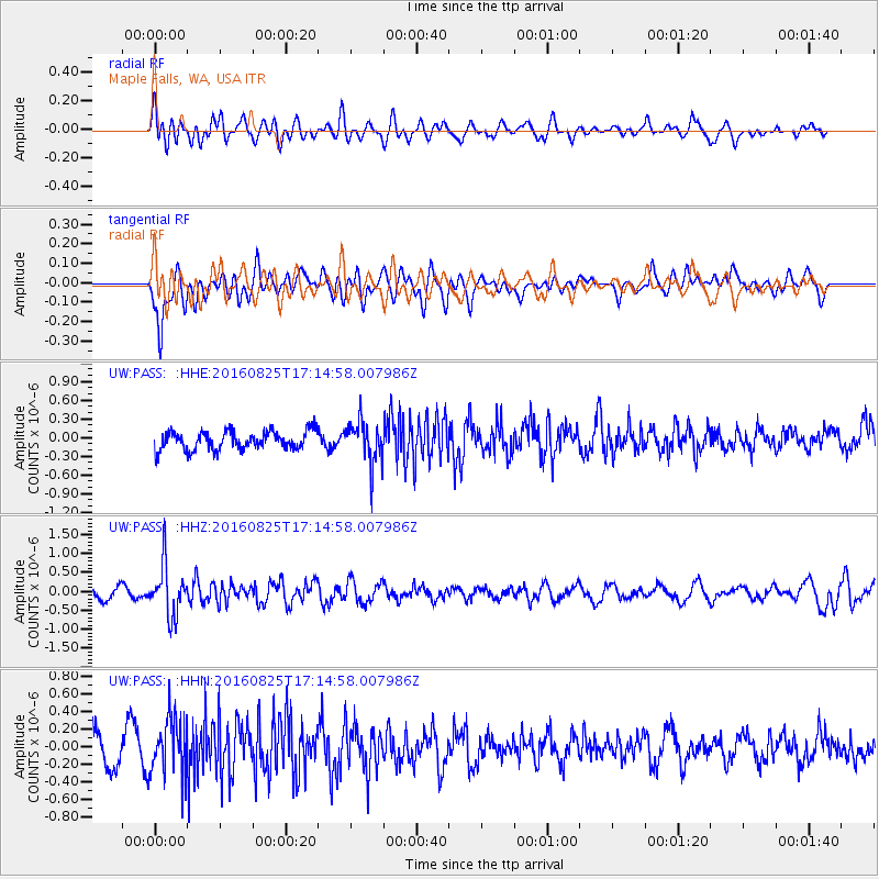
PASS Maple Falls, WA, USA - Earthquake Result Viewer
*The percent match for this event was below the threshold and hence no stack was calculated.
| Earthquake location: |
Southeast Of Honshu, Japan |
| Earthquake latitude/longitude: |
30.6/137.8 |
| Earthquake time(UTC): |
2016/08/25 (238) 17:04:43 GMT |
| Earthquake Depth: |
456 km |
| Earthquake Magnitude: |
5.9 MWW, 5.9 MWB |
| Earthquake Catalog/Contributor: |
NEIC PDE/NEIC COMCAT |
|
| Network: |
UW Pacific Northwest Regional Seismic Network |
| Station: |
PASS Maple Falls, WA, USA |
| Lat/Lon: |
49.00 N/122.09 W |
| Elevation: |
174 m |
|
| Distance: |
73.6 deg |
| Az: |
42.523 deg |
| Baz: |
297.78 deg |
| Ray Param: |
$rayparam |
*The percent match for this event was below the threshold and hence was not used in the summary stack. |
|
| Radial Match: |
49.899952 % |
| Radial Bump: |
400 |
| Transverse Match: |
65.7975 % |
| Transverse Bump: |
400 |
| SOD ConfigId: |
11737051 |
| Insert Time: |
2019-04-25 09:07:20.923 +0000 |
| GWidth: |
2.5 |
| Max Bumps: |
400 |
| Tol: |
0.001 |
|
Signal To Noise
| Channel | StoN | STA | LTA |
| UW:PASS: :HHZ:20160825T17:14:58.007986Z | 3.6616766 | 6.710284E-7 | 1.8325713E-7 |
| UW:PASS: :HHN:20160825T17:14:58.007986Z | 1.9423895 | 3.2257367E-7 | 1.6607055E-7 |
| UW:PASS: :HHE:20160825T17:14:58.007986Z | 2.2368107 | 3.340144E-7 | 1.4932618E-7 |
| Arrivals |
| Ps | |
| PpPs | |
| PsPs/PpSs | |


