You are here: Home > Network List > AV - Alaska Volcano Observatory Stations List
> Station SPCR Ckakachatna River, Mount Spurr, Alaska > Earthquake Result Viewer
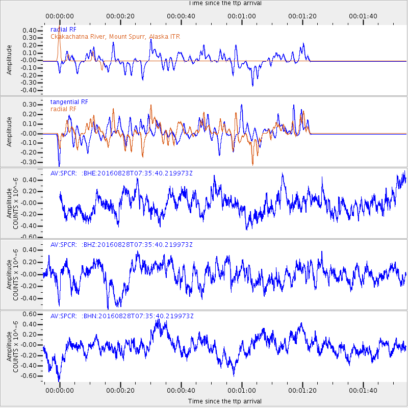
SPCR Ckakachatna River, Mount Spurr, Alaska - Earthquake Result Viewer
*The percent match for this event was below the threshold and hence no stack was calculated.
| Earthquake location: |
Irian Jaya, Indonesia |
| Earthquake latitude/longitude: |
-2.8/138.4 |
| Earthquake time(UTC): |
2016/08/28 (241) 07:23:50 GMT |
| Earthquake Depth: |
28 km |
| Earthquake Magnitude: |
5.7 MB |
| Earthquake Catalog/Contributor: |
NEIC PDE/NEIC COMCAT |
|
| Network: |
AV Alaska Volcano Observatory |
| Station: |
SPCR Ckakachatna River, Mount Spurr, Alaska |
| Lat/Lon: |
61.20 N/152.21 W |
| Elevation: |
984 m |
|
| Distance: |
82.6 deg |
| Az: |
27.186 deg |
| Baz: |
250.458 deg |
| Ray Param: |
$rayparam |
*The percent match for this event was below the threshold and hence was not used in the summary stack. |
|
| Radial Match: |
53.91283 % |
| Radial Bump: |
324 |
| Transverse Match: |
49.151592 % |
| Transverse Bump: |
305 |
| SOD ConfigId: |
11737051 |
| Insert Time: |
2019-04-25 09:10:56.949 +0000 |
| GWidth: |
2.5 |
| Max Bumps: |
400 |
| Tol: |
0.001 |
|
Signal To Noise
| Channel | StoN | STA | LTA |
| AV:SPCR: :BHZ:20160828T07:35:40.219973Z | 1.2213373 | 2.1594553E-7 | 1.7681072E-7 |
| AV:SPCR: :BHN:20160828T07:35:40.219973Z | 2.105276 | 3.8724176E-7 | 1.8393871E-7 |
| AV:SPCR: :BHE:20160828T07:35:40.219973Z | 0.8382722 | 1.3266663E-7 | 1.5826198E-7 |
| Arrivals |
| Ps | |
| PpPs | |
| PsPs/PpSs | |


