You are here: Home > Network List > US - United States National Seismic Network Stations List
> Station RSSD Black Hills, South Dakota, USA > Earthquake Result Viewer
RSSD Black Hills, South Dakota, USA - Earthquake Result Viewer
| Earthquake location: |
Caribbean Sea |
| Earthquake latitude/longitude: |
19.0/-81.4 |
| Earthquake time(UTC): |
2004/12/14 (349) 23:20:13 GMT |
| Earthquake Depth: |
10 km |
| Earthquake Magnitude: |
6.2 MB, 6.7 MS, 6.8 MW, 6.8 MW |
| Earthquake Catalog/Contributor: |
WHDF/NEIC |
|
| Network: |
US United States National Seismic Network |
| Station: |
RSSD Black Hills, South Dakota, USA |
| Lat/Lon: |
44.12 N/104.04 W |
| Elevation: |
2060 m |
|
| Distance: |
31.4 deg |
| Az: |
327.911 deg |
| Baz: |
135.727 deg |
| Ray Param: |
0.07906898 |
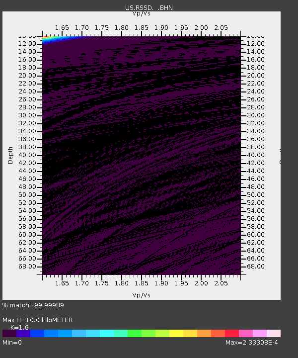
| Estimated Moho Depth: |
10.0 km |
| Estimated Crust Vp/Vs: |
1.60 |
| Assumed Crust Vp: |
6.242 km/s |
| Estimated Crust Vs: |
3.901 km/s |
| Estimated Crust Poisson's Ratio: |
0.18 |
|
| Radial Match: |
99.99989 % |
| Radial Bump: |
2 |
| Transverse Match: |
99.952446 % |
| Transverse Bump: |
4 |
| SOD ConfigId: |
110165 |
| Insert Time: |
2010-03-05 06:31:47.201 +0000 |
| GWidth: |
2.5 |
| Max Bumps: |
400 |
| Tol: |
0.001 |
|
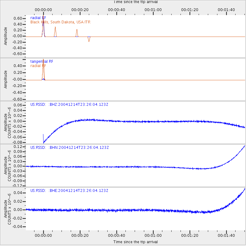
Signal To Noise
| Channel | StoN | STA | LTA |
| US:RSSD: :BHN:20041214T23:26:04.123Z | 0.92152894 | 9.9127755E-9 | 1.0756879E-8 |
| US:RSSD: :BHE:20041214T23:26:04.123Z | 0.85730064 | 3.810045E-9 | 4.4442343E-9 |
| US:RSSD: :BHZ:20041214T23:26:04.123Z | 0.91445947 | 2.3363237E-8 | 2.5548685E-8 |
| Arrivals |
| Ps | 1.0 SECOND |
| PpPs | 3.8 SECOND |
| PsPs/PpSs | 4.9 SECOND |


